Overview of Drone Photography in Real Estate
Drone photography has revolutionized the way properties are showcased in the real estate industry, offering a dynamic and immersive perspective that traditional methods cannot match. By utilizing unmanned aerial vehicles (UAVs), agents and developers can capture expansive aerial shots, highlighting a property's size, layout, and surrounding environment with unprecedented clarity and detail. This technological advancement enhances marketing efforts, allowing potential buyers to get a comprehensive view of a property before scheduling a visit.
In Miami, a city renowned for its luxurious estates, waterfront properties, and vibrant neighborhoods, drone photography has become an integral part of innovative marketing strategies. The ability to produce high-resolution, cinematic-quality visuals has made property listings more attractive, engaging, and informative. As the real estate market in Miami continues to grow and compete on a global scale, the adoption of drone technology provides a competitive edge, showcasing properties in a way that resonates with modern buyers and investors.

The expanding popularity of drone photography isn't confined to luxury homes alone; it spans across commercial real estate, development projects, and even vacant land. The ability to document large parcels of land, identify potential building sites, and illustrate neighborhood features makes drone imagery an invaluable tool for stakeholders involved in real estate transactions and development planning.
As technology advances and drone equipment becomes more accessible, more real estate professionals in Miami are incorporating aerial photography into their marketing portfolios. This shift not only enhances visual storytelling but also aligns with buyer preferences for interactive and immersive property viewing experiences. Consequently, drone photography has established itself as a vital component of modern real estate marketing strategies in Miami.
Legal Regulations and Permits in Miami
When integrating drone photography into real estate marketing efforts, it is imperative to adhere to the established procedures and protocols governing drone operations within Miami. Operators must obtain the necessary permits and follow specific guidelines to ensure that aerial filming is conducted responsibly and in accordance with local standards. The city enforces regulations designed to maintain safety, privacy, and airspace management, which include registration of drone devices with federal authorities, adherence to altitude limitations, and restrictions on flight zones. The process begins with registering the drone with the Federal Aviation Administration (FAA) if the device weighs more than 0.55 pounds. This registration process involves providing details about the operator and drone, which helps streamline oversight and ensures accountability. Additionally, operators need to secure a Remote Pilot Certificate from the FAA, demonstrating their knowledge of operational safety, airspace rules, and privacy considerations. For real estate professionals and photographers, obtaining appropriate clearances before drone flights is crucial. This entails planning flights to avoid no-fly zones, such as near airports, government buildings, or other sensitive areas. Miami's dense urban environment necessitates careful route planning and coordinated efforts with local authorities when required. In some instances, special permissions or waivers may be needed for complex or elevated shots in certain neighborhoods. Responsible drone use also involves respecting privacy rights of residents and other individuals. This includes avoiding intrusive filming in private spaces and maintaining a respectful distance from property boundaries. Establishing clear communication with property owners prior to aerial shoots can help mitigate potential concerns and foster trust. Complying with these regulations not only ensures legal operation but also demonstrates professionalism and integrity. As the industry continues to develop, staying current with evolving rules is essential for maintaining a reputable image and delivering high-quality, compliant visual content that enhances property marketing endeavors.
Technical Aspects of Drone Photography
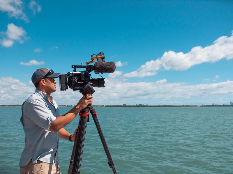
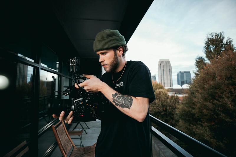
To achieve top-quality real estate visuals that captivate potential buyers, understanding the technical elements of drone photography is essential. High-resolution imaging capabilities are fundamental; modern drones equipped with 4K or even 8K cameras enable capture of crisp, detailed images that showcase a property's best features. These cameras should also offer adjustable gimbals for stabilization, ensuring smooth footage even in windy conditions.
Lighting conditions significantly influence the quality of aerial shots. Conducting flights during optimal times, such as early mornings or late afternoons, can enhance natural lighting and bring out vibrant colors, thus highlighting the property's curb appeal. Advanced photographers utilize various lens settings, including wide-angle and panoramic options, to emphasize the spatial dimensions of estates and landscapes.
Camera settings such as ISO, shutter speed, and aperture must be carefully calibrated to adapt to changing environmental conditions. Proper calibration prevents issues like overexposure or motion blur, maintaining professional standards in all shot types. Employing HDR (High Dynamic Range) techniques can also ensure detailed visualization in scenes with significant contrast, such as bright skies against shaded grounds.
Flight planning is an equally critical technical aspect. Real estate drone operations involve meticulous pre-flight assessments to ensure safety, optimal positioning, and shot composition. Flight paths should be mapped meticulously to cover all angles while respecting surrounding structures and privacy zones. Flying at appropriate altitudes—usually between 50 to 150 feet—ensures comprehensive coverage without violating visual or spatial expectations.
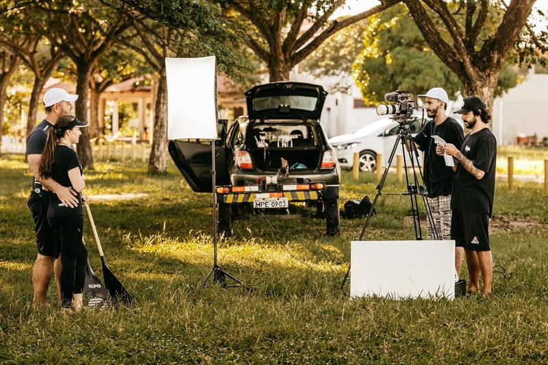
Post-production editing also plays a vital role. Color correction, stabilization, and image enhancement techniques can be applied to raw footage to produce polished visual content. Combining aerial shots with ground-level images creates a comprehensive marketing package, offering potential buyers an immersive view that enhances engagement.

Legal Regulations and Permits in Miami
When incorporating drone photography into real estate marketing strategies in Miami, understanding the applicable regulations and procedural requirements is essential. These commitments ensure that drone operations are conducted responsibly, maintaining safety standards and protecting public interests.
Operators must adhere to guidelines established by the Federal Aviation Administration (FAA), which oversee unmanned aircraft systems nationwide. This includes obtaining necessary certifications for commercial drone use, such as a Part 107 Remote Pilot Certificate. Such certifications validate that operators possess the technical knowledge to fly drones safely and responsibly, minimizing risks to people, property, and airspace.

Prior to each shoot, operators should verify the specific airspace restrictions in the area surrounding the property. Miami features numerous zones with varying clearance levels, including airports, helipads, and protected wildlife areas. Recognizing these zones and planning flight paths accordingly helps prevent inadvertent violations that could disrupt operations or lead to enforcement actions.
In addition to FAA regulations, local ordinances may impose restrictions related to privacy and property use. While government bodies generally promote innovative real estate marketing techniques, respecting the privacy of residents in high-density neighborhoods remains paramount. Gaining explicit consent from property owners and neighboring residents when appropriate ensures transparency and fosters positive community relations.
Furthermore, obtaining permits or permissions from city authorities may be advisable or required for certain drone flights, especially those involving complex maneuvers or flights over private property. Engaging with local planning offices or relevant agencies ahead of time streamlines the process and safeguards against unforeseen complications.
Operational Best Practices for Legal and Responsible Drone Use
- Conduct thorough pre-flight assessments, including checking weather conditions which could impact safety.
- Develop detailed flight plans outlining altitude, routes, and camera angles to optimize coverage and compliance.
- Use updated geofencing technology to avoid restricted zones dynamically.
- Ensure all personnel involved are trained in drone safety protocols and local regulations.
- Maintain clear documentation of permits, certifications, and flight logs for accountability and review.
By diligently following these guidelines and maintaining awareness of evolving rules, Miami-based real estate professionals can leverage drone photography effectively while adhering to official standards, ensuring consistent quality and professionalism in visual marketing assets.
Technical Aspects of Drone Photography
For Miami real estate professionals aiming to utilize drone photography effectively, understanding the technical nuances of drone operation is essential. High-quality imagery requires a combination of advanced equipment, precise calibration, and skilled operators who can adapt to dynamic environmental conditions.
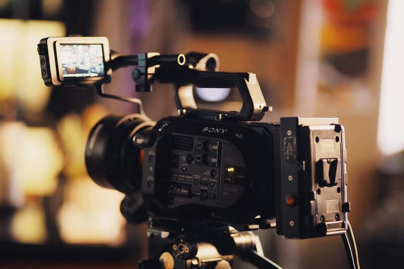
Drone cameras used in real estate photography typically feature high-resolution sensors, often surpassing 20 megapixels, ensuring crisp, detailed images that showcase properties in their best light. Lens selection plays a crucial role; wide-angle lenses are standard, allowing comprehensive coverage of property exteriors and surrounding landscapes, while specialized lenses such as polarizers can enhance color saturation and reduce glare.
Flight parameters, including altitude and camera angle, must be carefully calibrated to maximize visual appeal while complying with safety guidelines. For example, maintaining an optimal altitude—usually between 50 to 150 feet—ensures that aerial images reveal a property's full scope without distortion. Dynamic camera angles, such as high oblique shots or low landscape views, can add perspective and depth to marketing visuals.
Pre-flight systems checks are mandatory to verify battery health, GPS connectivity, and sensor functionality. Employing real-time telemetry allows pilots to monitor drone status and ensure stability during flights. Additionally, the integration of advanced stabilization systems minimizes vibrations, resulting in sharper images.
Lighting conditions are another critical factor. Conducting drone flights during the golden hours—shortly after sunrise or before sunset—can enhance the natural beauty of the property, providing warm tones and softer shadows that accentuate architectural details.
Legal Regulations and Permits in Miami
To conduct real estate drone photography ethically and professionally in Miami, adhering to established regulations and obtaining necessary permits is crucial. Although the specific licensing process may involve different agencies and documentation, following official procedures ensures the safety of both drone pilots and the public, while safeguarding the quality of the visual content produced.
In Miami, drone operators should register their aircraft with the appropriate federal agency responsible for airspace management. This registration process includes providing detailed information about the drone, its specifications, and the operator’s credentials. Maintaining proper registration not only complies with official standards but also enhances credibility when engaging with clients and local authorities.
Continuing education on operational guidelines is essential. Pilots should engage with authorized training programs that cover safe flying practices, aeronautical knowledge, and emergency procedures. Certified training not only refines technical skills but also demonstrates a commitment to maintaining high standards in drone operations.
Before each aerial shoot, a comprehensive flight plan should be submitted if required by local aviation authorities, especially for flights over densely populated or sensitive areas. This plan outlines flight paths, altitudes, and times, which helps prevent conflicts with other airspace users and ensures compliance with noise and privacy considerations.
Permits specific to real estate photography may involve permissions from city planning departments or property owners. Securing explicit approvals can prevent possible disruptions or misunderstandings during the shooting process and supports a smooth workflow.
Operators should also familiarize themselves with restrictions related to flying height, flight hours, and proximity to airports or heliports. Respecting these criteria guarantees safe operations that align with official standards and instills confidence among clients and stakeholders.
By systematically following official guidelines for registrations, permits, and operational protocols, Miami-based real estate drone photography professionals can deliver high-quality visual content without interruption, all while demonstrating their commitment to professionalism and regulatory compliance.
Technical Aspects of Drone Photography
Achieving high-quality real estate imagery relies heavily on understanding the technical components that underpin successful drone photography. Professional-grade drones equipped with advanced cameras are essential for capturing detailed, crisp, and vibrant images that highlight a property's best features. These devices typically feature stabilization systems like gimbals, which ensure smooth footage and reduce blurriness caused by drone movement or wind interference. Critical to drone photography is the choice of camera lens and resolution. High-resolution sensors, often capable of capturing 4K video and detailed stills, provide clarity and flexibility in post-production editing. Wide-angle lenses are commonly used to showcase expansive property views, including surrounding landscapes that emphasize location advantages. Sensor quality and dynamic range also play vital roles in capturing scenic details under various lighting conditions. A drone capable of detailed exposure adjustments helps prevent overexposure of bright areas and retains detail in shadowed sections, producing balanced images suitable for marketing campaigns. Flight stability and endurance are equally important. Flight controllers with GPS and GLONASS capabilities enable precise navigation and positioning, allowing for complex flight paths that cover the property extensively while maintaining safety. Battery life affects the duration of each shoot; thus, professional operators often carry multiple batteries to ensure comprehensive coverage. Post-processing is an integral component of drone photography. Raw image formats allow for extensive editing, enhancing colors, correcting distortions, and optimizing compositions for maximum visual impact. Skilled photographers understand the nuances of image editing to produce compelling visuals that resonate with prospective buyers. By leveraging the latest advancements in drone technology and camera systems, real estate professionals in Miami can significantly augment their marketing assets, creating immersive and compelling visual narratives that stand out in competitive markets.
Utilizing Official and Approved Methods for Drone Photography in Miami
Executing real estate drone photography in Miami involves adhering to official procedures and utilizing approved equipment and techniques. Professionals and property marketers should focus on performing comprehensive site assessments to identify optimal flying zones that maximize property appeal while ensuring safety and compliance. This process includes evaluating local airspace restrictions, potential obstacles, and nearby structures, which guides planning for safe and effective drone operations.
Employing commercially certified drones equipped with advanced stabilization, high-resolution cameras, and reliable GPS navigation is fundamental for capturing high-quality imagery. These drones often feature multiple flight modes, automated waypoint missions, and obstacle avoidance sensors, enabling precise and safe flight paths around properties without manual intervention. Such capabilities are vital for capturing expansive shots, aerial walk-throughs, and detailed shots of architectural features.
For optimal results, drone operators should also adhere to manufacturers' guidelines for maintenance and operation, ensuring the drone's systems are functioning correctly before each flight. Regular calibration of sensors and software updates help maintain high performance levels and reduce the risk of technical issues during critical shoots.
In addition, conducting pre-flight checks and risk assessments is essential. These assessments include verifying the drone's battery levels, signal strength, and wind conditions. Establishing clear communication protocols with any team members involved during the shoot enhances safety and coordination. Documentation of flight plans and obtaining necessary permissions prior to filming ensures full adherence to established procedures and a smooth operational process.
Optimizing Aerial Content While Ensuring Compliance
- Utilize approved drone software for mission planning and flight automation, which helps maintain flight safety and maximizes coverage.
- Incorporate weather forecasts and wind speed data to determine optimal flying conditions, reducing the risk of drone instability or accidents.
- Implement GPS-based geo-fencing to restrict drone flight within authorized areas, avoiding sensitive zones and legal boundaries.
- Maintain detailed records of all flights, including flight plans, battery usage, and safety checks, to support accountability and transparency.
- Work exclusively with licensed and experienced drone operators or production agencies that follow established protocols and standards for aerial photography.
By strictly following these methods, Miami real estate professionals can leverage drone technology responsibly and effectively, ensuring that each shoot meets top standards of quality and professionalism while complying with all operational guidelines.