Importance of Aerial Photography in Real Estate Marketing
In the highly competitive real estate market of Miami, professionals continually seek innovative ways to capture the attention of potential buyers. Aerial photography has emerged as a vital tool in this landscape, offering distinctive perspectives that ground-level imagery simply cannot achieve. By utilizing drones and other aerial imaging technologies, real estate agents and marketers can showcase properties in a comprehensive manner, highlighting their unique features and surrounding environment.
One of the primary advantages of aerial photos is their ability to present a property’s full scope, including extensive land areas, distinctive architectural elements, landscaping, and proximity to amenities. Prospective buyers gain a clearer understanding of the property’s layout and contextual positioning within its neighborhood, fostering a more engaging and informed viewing experience. In Miami, where waterfront estates, sprawling estates, and modern developments are prevalent, aerial shots can dramatically enhance listing appeal by visually emphasizing scale and setting.
High-quality aerial images can evoke an emotional response and increase a property’s perceived value. Buyers often make quicker decisions when they have a comprehensive visual overview at their disposal. Furthermore, listing photos with compelling aerial views tend to generate higher engagement on digital platforms, attracting more potential buyers and generating organic interest. This visual edge is crucial in Miami’s bustling real estate environment, where competition is fierce and standing out is key.

Beyond marketing, aerial photos help highlight features such as large driveways, pool areas, outdoor entertainment spaces, and proximity to landmarks like beaches, parks, and cityscapes. These visuals enable sellers and agents to communicate the essence and lifestyle quality associated with Miami properties, making listings more compelling and trustworthy.
Additionally, aerial imagery viewed in conjunction with interior photography can provide a comprehensive story of a property, fostering trust and transparency. This combination reassures buyers by giving them a holistic view that encompasses both the finer details and the expansive context of the home.
In summary, aerial photography elevates the storytelling power of real estate marketing, providing rich, detailed visuals that resonate with prospective buyers and significantly enhance the perceived value of listings in Miami’s dynamic market.
Legal Regulations and Permits for Aerial Photography in Miami
In Miami, conducting aerial photography, particularly for real estate purposes, requires adherence to specific guidelines and obtaining necessary authorizations. Ensuring compliance with local ordinances involves understanding the operational parameters established by the Federal Aviation Administration (FAA) and municipal authorities. Modified regulations may include restrictions on flight altitudes, no-fly zones, and specific areas designated for drone operations, especially in densely populated or sensitive zones.
Property owners and real estate professionals should verify whether any restricted airspaces overlap with the areas they intend to survey. For instance, proximity to airports, military installations, and critical infrastructure often necessitates additional clearances or notifications prior to flight. Proper documentation and permits are essential to avoid penalties and ensure smooth execution of aerial shoots.
Engaging with licensed and experienced drone service providers familiar with Miami’s regulatory landscape can facilitate a seamless process. These specialists typically handle all requisite filings, coordinate with authorities for necessary permissions, and adhere to safety standards that protect both operators and the surrounding community. Additionally, maintaining an updated understanding of ongoing regulatory changes is vital for continuous compliance in this evolving landscape.
Utilizing legitimate service providers not only helps in legal compliance but also guarantees the quality and professionalism of the imagery produced. Such providers often work with certified drone pilots who are knowledgeable about local airspace rules, further ensuring that the shoots are conducted efficiently and within legal boundaries.
In sum, thorough planning, understanding of relevant regulations, and collaboration with qualified aerial photography experts are essential steps for real estate marketing teams aiming to leverage aerial imagery effectively and responsibly in Miami's competitive market environment.
Legal Regulations and Permits for Aerial Photography in Miami
Securing aerial imagery for real estate in Miami involves adherence to established procedures designed to ensure safe and responsible use of unmanned aircraft systems. Before conducting any aerial shoot, it is crucial to obtain the necessary authorizations from relevant local authorities. This process typically includes submitting detailed flight plans that specify flight paths, altitudes, and operational parameters to ensure they do not interfere with manned aircraft or other airspace users.
Utilizing official channels to request airspace clearance often involves providing documentation that demonstrates the scope and safety measures of the planned operation. This may include proof of pilot certification, drone registration, and a comprehensive safety plan. Employing certified drone operators familiar with Miami's airspace rules can greatly streamline this process. They are equipped to handle all required filings and coordinate with the appropriate authorities, reducing the risk of disruptions or infringements.
It is also advantageous to stay informed about any recent modifications to aerial operation regulations in the region. Staying proactive in this regard helps maintain continuous compliance and supports a smooth workflow. While navigating these processes may seem complex, partnering with qualified aerial photography professionals ensures adherence to all necessary standards, facilitating high-quality visual content without legal concerns.

Furthermore, clear communication with local authorities can clarify individual requirements based on specific properties and locations. For example, flights over certain neighborhoods or near sensitive infrastructure may have additional considerations or restrictions. In all cases, maintaining transparency and thorough documentation minimizes potential issues and illustrates a commitment to responsible aerial photography practices.
By engaging with reputable service providers experienced in Miami’s airspace environment, real estate professionals can confidently incorporate impressive aerial imagery into their marketing strategies. Such collaboration not only promotes compliance but also enhances the overall quality and impact of the images produced.

In summation, navigating the legal framework for aerial photography involves a combination of official permit acquisition, expert guidance, and thorough planning. These steps ensure the execution of visually compelling content that aligns with operational guidelines, thereby reinforcing professional integrity and promoting effective real estate marketing efforts in Miami.
Utilizing Legitimized Techniques for Aerial Photography in the Miami Real Estate Market
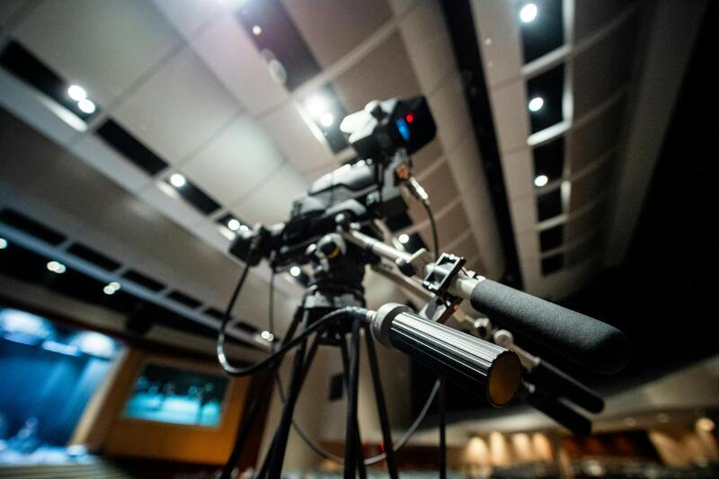
When integrating aerial imagery into property marketing strategies, it is crucial to employ methods that adhere to established standards and utilize official equipment operated by trained professionals. High-quality drone platforms equipped with advanced stabilization technology enable capturing crisp, detailed visuals that truly showcase a property’s unique features from an elevated perspective. These specialized devices, when operated by licensed pilots, ensure the correct execution of flight paths and image capture angles, resulting in compelling visual narratives for prospective buyers.
Professional aerial photography services often rely on regulated flight planning, which involves detailed pre-flight assessments and adherence to prescribed guidelines. This systematic approach guarantees that every shot is taken within a safe zone, avoiding potential risks while maximizing image quality. Employing certified operators also minimizes the chances of interference with other airspace users, ensuring each campaign proceeds smoothly and efficiently.
Choosing an experienced service provider who understands Miami’s aerial regulations and local environmental considerations can significantly improve the outcome of a campaign. These professionals use established flight planning tools, such as official aeronautical charts, to precisely map out flight paths that respect no-fly zones and maintain safe distances from sensitive infrastructure. By strictly following these procedures, real estate agents can confidently incorporate aerial visuals into their listings, knowing they are aligned with best practices and official standards.
The raw imagery captured undergoes meticulous post-processing, including color correction, perspective adjustments, and sky enhancements, to ensure the final presentation is visually appealing and accurately represents the property. High-resolution images allow for detailed views of property exteriors, landscaping, and surrounding features, creating a comprehensive visual story that photographs alone cannot achieve. In doing so, agents can highlight a property's proximity to parks, water bodies, or transportation hubs, providing prospective buyers with a nuanced understanding of its location advantages.
In addition, integrating drone-captured photos into virtual tours or online listings enhances user engagement and increases the property’s online visibility. These compelling visuals can make listings stand out across digital platforms, attracting more potential buyers and improving marketing conversion rates. To maintain consistency and compliance, property professionals should collaborate with reputable aerial photography providers who prioritize adhering to official standards while delivering high-quality, impactful imagery.
Legal Regulations and Permits for Aerial Photography in Miami
Engaging in aerial photography for real estate purposes within Miami necessitates adherence to established procedures and official guidelines to ensure safe and compliant operations. More than just capturing compelling images, this process involves a thorough understanding of designated airspace rules, restricted zones, and necessary permissions from relevant authorities. Utilizing authorized tools, such as official aeronautical charts, real estate professionals and aerial photographers can accurately determine appropriate flight paths that avoid no-fly zones, critical infrastructure, and sensitive areas like airports or governmental buildings.
Securing permits may involve submitting detailed flight plans that specify flight altitudes, times, and locations. These plans are reviewed by relevant agencies to confirm safety and compliance. It is essential to establish clear communication channels with local authorities and aviation bodies to facilitate the approval process and to stay informed about any temporary restrictions or special events that could impact flight permissions.
Moreover, the raw imagery, once captured, must undergo an array of post-processing procedures to optimize visual quality and accuracy. This includes color correction, perspective adjustments, and sky enhancements. High-resolution output enables detailed views of property exteriors, landscaping, and surrounding amenities, which significantly contribute to the property's appeal. The visual storytelling potential of aerial photos allows prospective buyers to assess proximities to parks, water features, transportation hubs, and other critical neighborhood elements.
Integrating these visuals into online listings and virtual tours is a strategic move to enhance engagement and visibility. Such compelling images can differentiate a property in the competitive Miami real estate market, attracting more targeted interest. Collaborating with reputable aerial photography providers ensures adherence to official procedures and standards while delivering top-tier imagery. This balanced approach guarantees that listings are not only visually captivating but also created within a framework of safety, compliance, and professionalism.
Strategies for Utilizing Aerial Photos in Real Estate Listings
Incorporating aerial photography into real estate listings requires careful consideration of presentation and placement to maximize their impact. High-quality aerial images should be prominently displayed on property websites, ideally as the hero images on both desktop and mobile platforms. Such imagery immediately captures the viewer's attention and conveys comprehensive spatial context that traditional ground-level photos may lack.
Beyond the main listing, aerial photos can be integrated into virtual tours and slideshow galleries, providing potential buyers with an immersive experience of the property's exterior, landscaping, and surrounding neighborhood. Embedding these images alongside detailed property descriptions allows for a cohesive narrative that highlights unique features like swimming pools, gardens, waterfront access, or nearby amenities. Visual storytelling through aerial perspectives enhances emotional engagement, making listings stand out in the competitive Miami market.
Another effective approach is to use interactive map overlays that combine aerial images with property boundaries, nearby landmarks, and transportation routes. This integration offers prospective buyers a spatial understanding of the property's location relative to key places, such as schools, shopping centers, and commuting corridors. When combined with detailed descriptions, these visuals support informed decision-making and foster trust in the listing's authenticity.

To ensure these images reach the widest audience, real estate professionals should optimize listings for search engines by including relevant keywords and current, high-quality aerial photos. Coupling aerial visuals with clear, concise descriptions and technical specifications also encourages engagement and improves ranking in digital marketplaces.
Best Practices for Capturing Aerial Property Photos
Achieving high-quality aerial images requires careful planning and execution. First, selecting optimal weather conditions is crucial; clear, sunny days with minimal wind provide the best lighting and stability for drone flights. Overcast days can diffuse sunlight and reduce harsh shadows, resulting in more evenly lit photos. Scheduling flights during golden hours—shortly after sunrise or before sunset—enhances the visual appeal of the images with warm, inviting tones.
Preparation also involves thorough site reconnaissance. Before flying, operators should evaluate potential obstacles like trees, power lines, or neighboring structures that could interfere with drone paths. Conducting a flyover survey helps identify the best angles and vantage points to showcase the property’s most attractive features, such as waterfront access, unique rooflines, or expansive lawns.
Stability and focus are essential for sharp, professional images. Using high-quality drones equipped with gimbals ensures smooth footage and minimizes motion blur. Adjusting camera settings—ISO, shutter speed, aperture—according to lighting conditions further enhances image clarity. Employing manual controls rather than automatic settings allows for precise adjustments tailored to each shot.
When framing shots, it's important to maintain a consistent altitude to ensure scale accuracy and create a cohesive visual narrative. Overlapping several images or using panoramic techniques can offer comprehensive views that give potential buyers a better understanding of the property’s layout and surroundings. Incorporating different vantage points, such as frontal, lateral, and top-down perspectives, provides a well-rounded portrayal that appeals to prospective buyers and investors.
Post-processing plays a significant role in finalizing the images. Adjustments in contrast, brightness, and color balance can enhance visual clarity and appeal without misrepresenting the property. Ensuring consistent editing styles across a portfolio maintains professionalism and brand identity. When combined, these best practices culminate in captivating visuals that elevate real estate listings and attract serious buyers.
Advanced Techniques and Technologies in Aerial Photography for Real Estate
As the industry continues to evolve, leveraging advanced techniques and cutting-edge technology becomes essential for creating impactful aerial imagery that boosts property visibility and appeal. High-resolution drone cameras, equipped with sophisticated stabilization and gimbal systems, enable photographers to capture detailed, stable shots even in challenging environmental conditions. This precision ensures that every image showcases the property’s features clearly and professionally.
Moreover, the integration of 3D mapping technology, often through photogrammetry, allows for the creation of immersive, accurate three-dimensional models of properties and landscapes. These models give potential buyers a virtual walkthrough experience, highlighting the property’s spatial relationships and scale. Such technologies not only provide a comprehensive visual representation but also support virtual tours and augmented reality applications, broadening the reach of real estate marketing campaigns.
Real estate professionals in Miami increasingly utilize hyper-realistic video content alongside aerial photos. High-definition drone videography captures fluid, dynamic views of properties and their surroundings, often incorporating cinematic techniques to evoke an emotional response from viewers. This trend aligns with the desire for more engaging and interactive listings that stand out in a competitive market.
Utilizing software for image stitching and panoramic creation enhances the presentation by delivering wide-angle views that encompass entire estates or neighborhoods. These panoramic images facilitate better contextual understanding, helping prospective buyers assess the property's setting within its environment. Automated flight planning tools also ensure that drone operations follow optimal routes for capturing extensive and consistent coverage of larger properties.
For real estate agents aiming to maximize visual impact, combining these innovative techniques with compelling storytelling in marketing materials enhances overall engagement. Aerial photography, when paired with modern technological advances, transforms traditional property presentations into dynamic, compelling visual narratives that resonate with buyers and investors alike.