Overview of Aerial Property Photography
Aerial property photography involves capturing high-quality images and videos of real estate assets from an elevated perspective, typically using unmanned aerial vehicles (UAVs), commonly known as drones. This innovative approach has gained substantial traction in recent years due to its ability to showcase properties from unique angles that are difficult to achieve with traditional ground photography. It offers a comprehensive view of a property’s exterior, surrounding landscapes, and neighboring features, providing potential buyers and investors with a detailed perspective that enhances marketing efforts and decision-making processes.
In the vibrant real estate market of Miami, aerial property photography has become an essential component of property presentation. The city’s diverse architecture, coastline, and lush neighborhoods benefit immensely from high-resolution aerial imagery that highlights the property’s setting within its environment. Developers, real estate agents, and marketing professionals utilize drone-captured images to create compelling listings, advertisements, and virtual tours that attract a broader audience. The popularity of these visual assets is driven by their ability to communicate scale, location, and lifestyle, often leading to quicker sales and increased property visibility.
This form of photography extends beyond real estate sales; it plays a significant role in urban planning, construction monitoring, and infrastructure development. Developers use aerial images to assess project progress, visualize site layouts, and showcase upcoming developments to investors and city officials. The versatility and clarity of aerial property photography continue to elevate its importance across various industries within Miami’s dynamic landscape.
Technical Aspects and Equipment
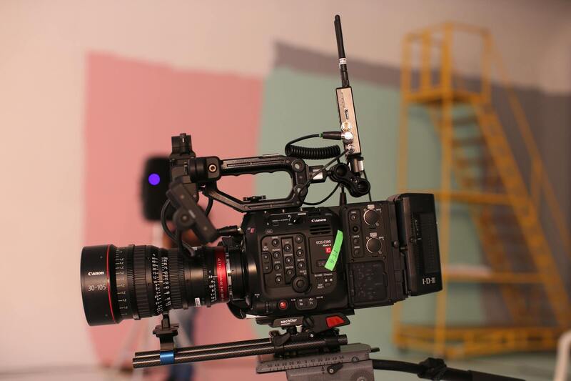
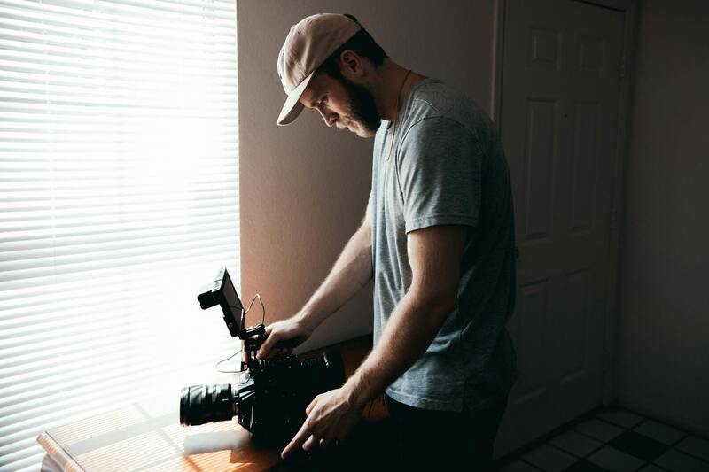
Executing high-quality aerial property photography requires sophisticated equipment and a thorough understanding of the necessary technical parameters. Modern drone technology offers a range of capabilities, from high-resolution cameras to advanced stabilization systems that ensure crisp, clear images even in challenging weather conditions. Professional-grade drones are equipped with gimbals that stabilize the camera to minimize vibrations and produce smooth footage, which is vital for capturing the detailed features of a property and its surroundings.
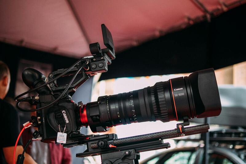
Camera specifications play a crucial role in the quality of aerial imagery. High-resolution sensors, such as 20MP or greater, allow for detailed close-up shots, while wide-angle lenses help encompass larger areas in a single frame. Many professional drones also support interchangeable lenses, giving photographers flexibility based on the project’s needs. For instance, a wide aperture lens can capture high-quality images in low-light scenarios, which is beneficial for shooting during dawn or dusk.
Battery life and flight duration are important considerations in planning aerial shoots. Advanced drones often support extended flight times of 20-30 minutes, allowing for comprehensive coverage of sizable properties. Additionally, automatic flight modes and waypoint navigation enable precise positioning and consistent image capture across multiple angles, saving time and ensuring the completeness of the shots.
Additional Equipment and Accessories
- GPS modules: Enhance navigation accuracy and stability during flight.
- Filters: ND filters help manage exposure in bright conditions for balanced images.
- Landing gear: Protect sensitive camera equipment during takeoff and landing.
- Remote controllers: Enable real-time image monitoring and manual adjustments for optimal shot composition.
Understanding the technical specifications and capabilities of aerial photography equipment ensures the delivery of professional imagery that meets client expectations and accurately showcases property features from strategic vantage points.
Technical Aspects and Equipment
Implementing aerial property photography demands a comprehensive understanding of the technical elements that go into capturing high-quality images. The choice of drone models plays a pivotal role, with professional-grade aircraft offering stability, advanced flight controls, and superior payload capacities. These drones typically feature multiple rotors for enhanced maneuverability and safety, allowing operators to navigate complex terrains around property sites with precision.
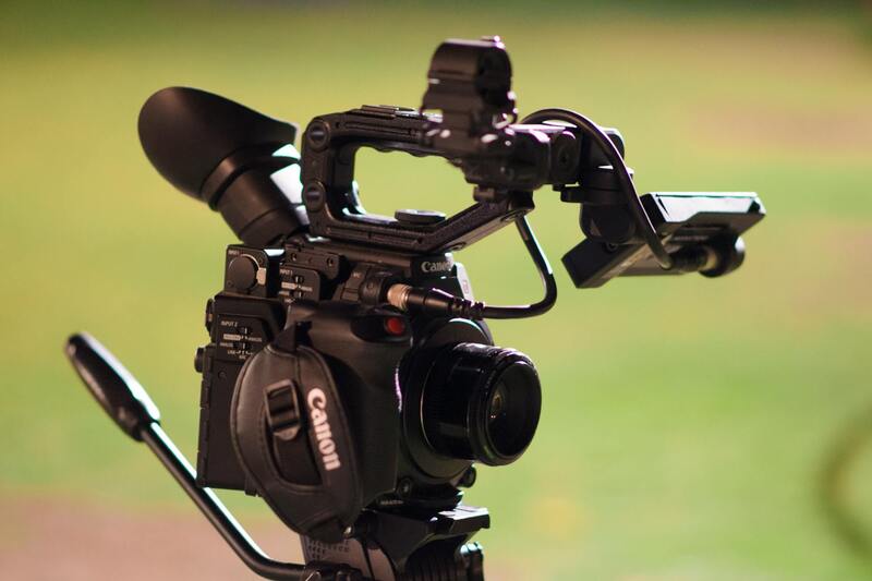
High-resolution cameras are central to quality aerial imaging. Many professional drones support interchangeable lens systems, enabling cinematographers to select optics suited for specific lighting conditions or detail levels. For instance, wide-angle lenses are ideal for capturing entire property layouts, while telephoto lenses are used to focus on particular architectural features or landscape details.
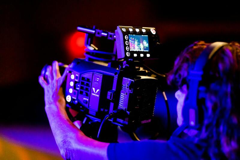
In addition to the core imaging hardware, stabilization technology — such as gimbal systems — is essential to counteract drone movement and deliver crisp, blur-free photos. These gimbals actively compensate for drone vibrations and external forces, maintaining a steady shot regardless of flight conditions.
Stability and safety are further reinforced through the integration of GPS modules, which guide accurate hover positions and enable automatic return-to-home functions. For capturing consistent shots from multiple angles, waypoint navigation systems allow precise planning of flight paths, ensuring comprehensive coverage of the property.
Accessories such as ND filters are used to control exposure levels in bright environments, preventing overexposed images. Landing gear protects sensitive camera equipment during takeoff and landing sequences, especially on uneven terrain or delicate surfaces. Remote controllers with real-time monitoring capabilities support manual adjustments to camera settings and framing, providing on-the-spot flexibility.
Understanding and selecting the right combination of drones, cameras, and stabilizers is crucial in ensuring each aerial shoot meets specific project requirements. High-caliber technology not only enhances image quality but also contributes to safer and more efficient flight operations, ultimately elevating the overall standard of aerial property photography services.
Technical Aspects and Equipment
Executing high-quality aerial property photography involves the integration of specialized equipment and advanced technological systems. Selecting the right drone platform is foundational, with models equipped with high-resolution cameras capable of capturing detailed images from various altitudes and angles. These cameras typically feature sensors with a minimum of 20 megapixels, ensuring crisp, vibrant visuals that highlight property features effectively.
Stabilization remains a core component in ensuring image clarity, especially in dynamic flight conditions. Gimbal stabilization systems, which counteract drone movements and external vibrations, are essential. These gimbals actively maintain camera orientation, delivering smooth, blur-free shots whether shooting from low or high elevations. The integration of GPS modules guides the drone’s precise positioning and hover stability, facilitating intricate shots and consistent framing across multiple takes.
Modern aerial photography hardware also incorporates various accessories to optimize image quality. ND filters, for example, enable filmmakers to control exposure in brightly lit environments, preventing overexposure and capturing balanced, detailed visuals. Landing gear designed for drone stability protects delicate camera components during takeoff and landing, particularly on uneven or sensitive surfaces.
Control systems are also sophisticated, often including remote controllers with real-time video monitoring and manual adjustment capabilities. These controllers allow operators to fine-tune camera angles, exposure settings, and flight paths mid-air, ensuring each shot aligns perfectly with project specifications.
Flight planning is enhanced through waypoint navigation systems, which facilitate detailed pre-mission routes. These systems enable precise coverage of a property from multiple perspectives, capturing comprehensive visuals that showcase the estate’s full scope. They also help in maintaining consistent flight parameters, ensuring safety and repeatability for ongoing projects.
In essence, the synergy of high-quality drones, stabilized camera systems, intelligent navigation, and flexible control accessories underpins the success of aerial property photography. This combination ensures that each capture is not only visually appealing but also precise, efficient, and tailored to client needs. mastering these technical elements is fundamental for any service provider aiming to deliver superior aerial imagery that truly captures the essence of properties.
Technical Aspects and Equipment
Achieving high-quality aerial property photography relies heavily on the right technical setup. Professional-grade drones equipped with stabilized gimbal cameras are essential for capturing sharp, distortion-free images that highlight the property's best features. These stabilization systems counteract drone movement and vibrations, resulting in crystal-clear visuals essential for marketing and documentation purposes.
The choice of camera is also critical. High-resolution sensors, capable of capturing detailed imagery, enable viewers to see intricate aspects of the property, from landscaping to architectural details. Many professional drones offer interchangeable lenses, providing flexibility to capture wide-angle shots or more focused, close-up images.
Navigation and control systems play a vital role in the execution of aerial property shoots. Advanced controllers with real-time video feedback allow operators to accurately position the drone, adjust camera parameters, and ensure comprehensive coverage of the property. GPS-assisted waypoint navigation systems facilitate pre-planned flight paths, which are essential for systematic, repeatable, and precise coverage of estate layouts.
Battery life is also a significant consideration. Drones with extended flight times permit prolonged sessions, enabling multiple angles and perspectives without frequent battery swaps. On-site safety features such as obstacle avoidance sensors contribute to smooth operations, especially in complex terrains or urban environments like Miami.
Investing in high-quality equipment ensures that each aerial capture meets professional standards, offering clients visually compelling content that enhances property listings, virtual tours, and promotional materials. The technical sophistication of the drone hardware, alongside skilled operation, fundamentally elevates the effectiveness of aerial property photography projects.
Complying with Legal Regulations and Ensuring Safe Aerial Operations in Miami
Conducting aerial property photography in Miami requires adherence to specific protocols that ensure responsible drone usage. While there are no explicit restrictions on the use of drones for real estate photography, operators must comply with established guidelines that promote safe and efficient flying practices. This includes obtaining necessary permissions when operating in sensitive areas, respecting privacy boundaries, and avoiding interference with manned aircraft. Proper planning and awareness of local airspace restrictions help in executing seamless shoots without disruptions.
Utilizing authorized flight zones and understanding temporary no-fly zones—such as near airport approaches or during special events—are crucial steps in the planning process. Miami's urban landscape and proximity to multiple airports necessitate diligent pre-flight research and coordination, especially for missions that require extended flight times or complex maneuvering.
Moreover, maintaining a safe operating environment involves regular equipment checks and adherence to operational best practices. Ensuring batteries are fully charged, camera systems are calibrated, and that the drone's firmware is up to date minimizes risks during flight. Operators should always perform pre-flight risk assessments, identifying potential obstacles such as tall structures, power lines, or dense foliage that could interfere with the drone's path.
In addition to technical readiness, drone pilots need to be proficient in maneuvering their aircraft within the legal framework. This includes maintaining line-of-sight during operations, avoiding flights over crowds, and respecting property rights. Licensed operators often undertake specific training to enhance their skills and understanding of regional regulations, which ultimately contributes to smoother and more professional aerial imaging sessions.
Maintaining comprehensive liability insurance is advisable, offering protection against unforeseen incidents that could impact third parties or result in property damage. This not only secures the service provider’s operations but also instills confidence among clients and property owners.
Ultimately, seamless aerial property photography hinges on diligent preparation, respect for airspace rules, and responsible drone management. This approach ensures the production of high-quality visuals while maintaining safety standards and operational integrity, which are fundamental in delivering professional results for Miami’s real estate market.
Technical Aspects and Equipment
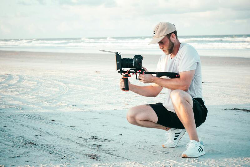
Achieving high-quality aerial property photographs requires understanding and selecting the right equipment tailored for real estate imaging. Drone technology has advanced significantly, providing a range of aircraft and camera systems suitable for capturing expansive property views and detailed architectural features. Professionals typically utilize multi-rotor drones equipped with high-resolution DSLR or mirrorless cameras that allow for crisp, vibrant images with excellent detail, even in varying lighting conditions. Such systems often offer interchangeable lenses, enabling tailored shot compositions that highlight the property’s unique features, from sprawling lawns to intricate architectural details.
Stability is paramount for sharp imagery; therefore, advanced gimbal stabilization systems are employed to counteract drone movements caused by wind or flight adjustments. This ensures smooth, blur-free shots that are ideal for both marketing materials and virtual tours. Additionally, flight control systems with GPS integration facilitate precise positioning and automated flight paths, enabling consistent framing and comprehensive coverage of properties from multiple angles.
Battery life and flight time are also crucial considerations. Modern drones feature high-capacity batteries allowing for extended flight durations, often up to 30 minutes per charge, which is essential for covering large properties efficiently. Backup batteries, along with portable charging setups, ensure that the shoot can continue uninterrupted, achieving comprehensive capture without logistical delays.
For post-flight processing, DSLR or mirrorless cameras often support RAW image capture, providing a broader dynamic range and greater flexibility during editing. Advanced drones also come equipped with obstacle avoidance sensors, further ensuring safe flights within complex property layouts, dense foliage, or proximity to other structures.
- High-resolution stabilized cameras for detailed imagery
- Multi-rotor drone platforms with GPS and autonomous flight modes
- Extended battery life for comprehensive coverage
- Obstacle avoidance sensors for safe operation
- RAW image capture capabilities for optimal post-processing
Efficiency in aerial property photography also depends on skilled pilots familiar with the latest drone regulations and technical best practices, ensuring safety and compliance while capturing the desired visuals.
Comprehensive Image Processing and Marketing Strategies for Aerial Property Photography
Maximizing the visual impact of aerial property images extends beyond capturing high-quality shots. The processing and marketing stages are fundamental to ensuring these images resonate with potential buyers or clients. Sophisticated editing techniques, tailored marketing strategies, and strategic image dissemination optimize the reach and effectiveness of aerial property photography in the competitive Miami real estate market.
Advanced Image Editing and Enhancement
Post-processing begins with selecting the best raw images captured during the flight. Utilizing professional editing software allows for precise adjustments that enhance clarity, color accuracy, and overall visual appeal. Techniques such as color correction, contrast refinement, and sharpening make structural details more prominent, creating captivating visuals that stand out in property listings.
HDR (High Dynamic Range) processing is especially beneficial for aerial shots involving challenging lighting conditions, balancing shadows and highlights to reveal intricate property details. Additionally, perspective correction ensures that buildings appear proportionate and true to scale, avoiding distortions caused by drone angles. Applying subtle vignettes subtly directs viewer attention toward the property’s focal points, creating a compelling visual narrative.
Integrating 3D and Interactive Visual Content
Incorporating 3D models or virtual tours generated from aerial photographs enhances client engagement. These immersive experiences enable viewers to explore the property from multiple vantage points, boosting online interest and encouraging physical visits. For high-profile listings, drone-captured footage combined with 3D environments provides a comprehensive view that emphasizes property uniqueness and surroundings.
Strategic Deployment of Images for Marketing Success
Effective marketing leverages the full spectrum of digital platforms to maximize exposure:
- Property Websites: Embedding high-resolution aerial images and virtual tours to showcase all angles comprehensively.
- Social Media Campaigns: Sharing engaging visuals on Instagram, Facebook, and LinkedIn, utilizing geotags and hashtags relevant to Miami real estate market trends.
- Real Estate Listings: Incorporating optimized images that highlight neighborhood context, proximity to amenities, and unique property features.
- Email Marketing: Sending professionally curated image galleries to prospective buyers and investors.
Each channel benefits from tailored image formats and resolutions, ensuring visual quality and loading efficiency. Consistency in branding and imagery style reinforces market presence and attracts targeted audiences.
Measuring Engagement and ROI
Utilizing analytics tools to monitor the performance of aerial property visuals informs ongoing marketing strategies. Metrics such as engagement rates, click-throughs, and inquiries help assess the effectiveness of images in driving interest. Data-driven adjustments, such as refining image presentation or targeting specific demographics, optimize marketing spend and yield better results.
By integrating professional editing and strategic marketing within the aerial property photography workflow, Miami real estate professionals can significantly elevate their property presentations. This comprehensive approach ensures captivating visuals that drive interest, facilitate faster sales, and establish a compelling market presence that leverages the full potential of drone technology.