Introduction to Aerial Real Estate in Miami
Miami's dynamic real estate market has experienced a transformative shift with the integration of aerial imaging techniques. This innovative approach involves capturing high-quality photographs and videos from elevated perspectives, typically through the use of drone technology. As a key component of modern marketing strategies, aerial real estate photography offers an expansive view of properties, showcasing their unique features and surrounding environments in ways that traditional ground-level content cannot achieve.
The significance of aerial imagery in Miami's real estate sector continues to grow, reflecting its ability to attract potential buyers and investors by providing comprehensive visual narratives of properties. From sprawling waterfront estates to bustling urban developments, aerial shots enable marketers to highlight neighborhood amenities, landscape details, and the overall scale of listings with remarkable clarity and impact.
Employing drone technology for property showcasing has become a crucial tool for real estate professionals seeking to stand out in a competitive market. It allows for detailed visuals that emphasize property size, architectural design, and proximity to key locations—factors that significantly influence buyer decisions. As the demand for visually compelling content rises, so does the reputation of aerial real estate as an essential element in Miami's property marketing landscape.
With ongoing advancements in drone technology and video editing capabilities, aerial real estate photography is increasingly accessible and versatile. It allows for creative shot compositions, dynamic flyovers, and immersive virtual tours, all of which contribute to elevating property listings and attracting a broader audience. Furthermore, the strategic use of aerial imagery aligns with the evolving expectations of modern property buyers, who value high-quality visual content as an integral part of their decision-making process.
In summary, aerial real estate photography is not merely a trend but a vital tool in Miami’s real estate marketing arsenal. Its ability to deliver engaging, detailed, and expansive views of properties helps agents and developers differentiate their listings and effectively communicate the unique character of each property within the city’s vibrant and diverse market.
Types of Aerial Shots Used in Real Estate Marketing
Effective aerial real estate marketing relies on a variety of shot types that highlight different aspects of a property. Each shot serves a specific purpose and can be strategically used to craft a compelling visual narrative. The selection of shot types depends on the features of the property, target audience, and the overall marketing strategy.
Wide-Angle Property Overviews
These shots capture entire properties within their surrounding environment, providing a comprehensive view that emphasizes the scale and setting. Wide-angle shots are ideal for showcasing large estates, waterfront properties, or homes with expansive landscape features. They help potential buyers visualize the property's footprint in relation to neighboring structures, natural features, and access points.
Detail-Focused Shots
While broad property views are essential, zoomed-in aerial shots can highlight notable architectural details, landscaping, swimming pools, or outdoor amenities. These images draw attention to the unique selling points of the property, especially those that might be less visible from ground level.
Flyover or Pathway Shots
These dynamic shots simulate a flight path over the property, providing a virtual tour experience. They are especially effective in illustrating the layout, internal flow, and connectivity of different outdoor spaces, such as gardens, patios, and driveways. Such shots generate an immersive feeling, helping buyers connect emotionally with the property.
Nighttime Aerials
Night shots, captured with specialized lighting or long exposure techniques, can showcase the property’s exterior lighting design, landscape illumination, and overall curb appeal during evening hours. They are particularly useful for high-end listings and properties with prominent outdoor lighting features.
Vertical and Oblique Angles
Vertical shots provide a direct overhead view, ideal for detailed depictions of the property's footprint. Oblique angles, taken at an angle rather than directly overhead, add depth and perspective, making the property appear more three-dimensional and visually engaging.
Legal and Safety Considerations in Miami
When employing aerial photography for real estate in Miami, adhering to established procedures and standards ensures smooth operational execution while maintaining safety for all involved. It is essential to operate with the appropriate permits and clearances, particularly when flying drones or other remote aircraft in areas with dense urban environments, commercial zones, or near private properties. Such permissions typically involve coordination with local authorities and property owners, especially if flights occur over private land or restricted airspace.
Conducting thorough risk assessments prior to flights helps identify potential hazards, such as obstacles, moving aircraft, or adverse weather conditions. This proactive approach minimizes incident risks and ensures that camera equipment, drones, and personnel are protected during shoots.
In Miami’s bustling urban landscape, drone operators must be proficient in navigation and emergency procedures. Adequate training in handling aerial devices and understanding the specific regulations governing unmanned aerial vehicles (UAVs) supports safe operations, especially when capturing complex property layouts or close-up shots of architectural features.
Additionally, maintaining current insurance coverage can provide financial protection in case of unforeseen incidents, damages, or accidents during drone operations. Rigorous adherence to altitude restrictions and no-fly zones established by local authorities preserves privacy and prevents interference with other aerial or ground-based activities.
Developing comprehensive safety protocols and keeping all involved personnel well-informed supports responsible aerial photography practices. This disciplined approach not only aligns with professional standards but also enhances credibility and trust with clients and stakeholders involved in Miami’s competitive real estate market.
Legal and Safety Considerations in Miami
When engaging in aerial real estate imaging within Miami, understanding the framework governing unmanned aerial vehicle operations is essential for smooth and compliant shoots. This involves thorough knowledge of local airspace regulations, including designated no-fly zones, altitude restrictions, and time-of-day limitations. Operators must also be aware of specific permit requirements for commercial drone use, which are typically obtained through the appropriate local or state agencies. These permissions are crucial for conducting aerial photography over residential, commercial, and multifaceted developments.
Implementing rigorous safety protocols is a fundamental component of professional aerial real estate practices. This includes pre-flight risk assessments that identify potential obstacles such as tall structures, power lines, and dense urban environments characteristic of Miami. Operational procedures should incorporate clear communication protocols among crew members, emergency response plans, and contingency measures for adverse weather conditions that might compromise flight safety or shot quality.
Privacy considerations are particularly pertinent in Miami, where properties are often situated in densely populated areas. Respect for residents’ and owners’ privacy can be maintained through specific flight paths, restricted shoot zones, and transparent communication with property stakeholders prior to filming. By adhering to these best practices, drone operators uphold professional standards and foster trust with clients and the broader community.
Insurance coverage plays a vital role in safeguarding against unforeseen incidents such as equipment damage, property impact, or accidental injury. Strategic planning around insurance not only enhances operational confidence but also demonstrates a commitment to responsible deployment of aerial technology.
Advanced training in drone navigation and emergency procedures equips operators to handle complex scenarios typical of Miami’s vibrant landscape. This includes skills for precise maneuvering amidst skyscrapers, capturing detailed architectural features, and executing smooth, stable shots even in congested areas. Moreover, familiarity with local airspace maps and collaboration with air traffic authorities streamline compliance efforts, facilitating uninterrupted creative executions.
Key Equipment and Techniques for Aerial Property Showcasing
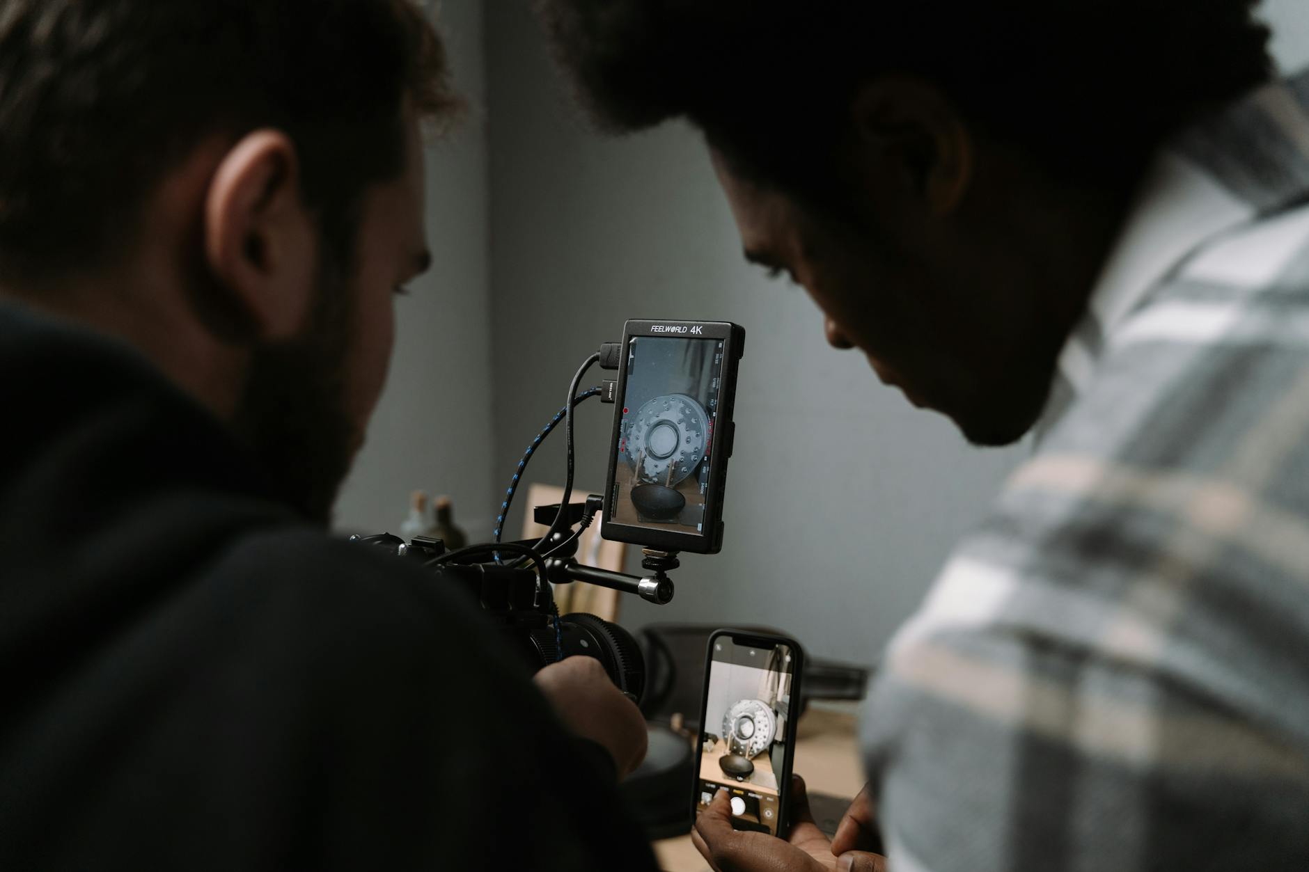
Achieving compelling aerial real estate footage requires a combination of advanced drone technology, precise camera settings, and expert filming techniques. High-quality drone platforms equipped with stabilized gimbals are essential for capturing smooth, cinematic shots that highlight property features and the surrounding landscape. These drones should have sufficient flight endurance to cover large properties and diverse shooting angles, including vertical, oblique, and panoramic perspectives.
Camera settings play a pivotal role in the clarity and visual appeal of aerial footage. Utilizing high-resolution cameras with adjustable aperture, ISO, and shutter speed allows operators to adapt to various lighting conditions, ensuring consistent image quality. Shooting in RAW format maximizes post-production flexibility, enabling color correction, exposure adjustments, and detail enhancement without sacrificing resolution.
Filming techniques focus on optimizing shot composition, smoothness, and narrative flow. For instance, establishing establishing shots from high altitudes provide a comprehensive view of the property in context. Progressive flight paths—such as circles, obliques, or orbit shots—emphasize architectural details and landscape features. Incorporating motion control rigs or automated flight paths ensures precise, steady movements, avoiding jitters or abrupt transitions that could detract from viewer experience.
Color grading and post-production editing are integral to refining footage, emphasizing the property’s best features and ensuring visual consistency. Proper footage integration—such as seamless transitions, appropriate music, and branded overlays—further enhances the overall marketing appeal, positioning the property as a premium listing in competitive Miami real estate markets.
Key Equipment and Techniques for Aerial Property Showcasing
Effective aerial real estate marketing relies heavily on specialized equipment and refined techniques to capture compelling visuals that highlight a property's unique features. The selection of appropriate drones, cameras, and accessories ensures high-quality footage that elevates listings and attracts potential buyers.
Essential Equipment for Aerial Real Estate Filming
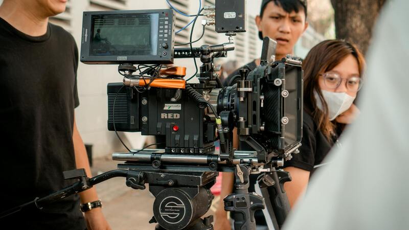
- Multirotor Drones: These agile, stable flying machines are the backbone of aerial real estate imaging. Models equipped with GPS stabilization, obstacle avoidance, and high payload capacities facilitate precise control and safe operation in diverse Miami environments.
- High-Resolution Cameras: Capturing crisp, detailed images requires cameras capable of shooting in 4K or higher resolutions. Incorporating gimbals helps maintain stability during flight, reducing shake and ensuring smooth footage.
- flight controllers and GPS Systems: Advanced flight controllers enable automated flight paths and precise positioning, essential for consistent shots. Integration with GPS technology assists in maintaining stable hover points and smooth transitions between different perspectives.
- Filters and Lenses: ND (Neutral Density) filters assist in controlling exposure under bright Miami daylight, while wide-angle lenses maximize field of view, capturing expansive property scenes effectively.
- Battery Systems and Spare Components: Extended flight sessions depend on reliable batteries. Carrying spares ensures uninterrupted filming, especially when covering large properties or multiple angles.
Techniques for Stunning Aerial Imagery
Creating captivating aerial footage involves strategic planning and execution of specific filming techniques designed to showcase a property's best aspects. These methods include:
- Pre-Flight Planning: Conduct comprehensive site assessments to identify optimal flight paths, lighting conditions, and potential obstacles. Mapping the property layout helps in designing efficient shoot sequences.
- Flight Path Optimization: Planning smooth, gradual movements such as horizontal sweeps, circular orbit shots, and elevation changes allows viewers to become fully immersed in the property's landscape. Executing slow, steady motions enhances visual appeal and allows viewers to absorb details.
- Camera Settings Adjustment: Fine-tuning aperture, ISO, and shutter speed ensures sharp images with vibrant colors, even under Miami's high sun. RAW format shooting provides maximum flexibility during post-processing.
- Dynamic Perspectives: Incorporating varied angles—top-down, oblique, and side views—creates a comprehensive view of the property, emphasizing architectural features and outdoor amenities.
- Stabilization Techniques: Utilizing gimbals and stabilizers minimizes vibrations, resulting in smooth footage. Automated flight paths with GPS waypoint navigation further enhance stability and consistency.
Post-Production Enhancements
Refinement through editing is vital in professional aerial real estate marketing. Adjustments such as color grading, exposure correction, and lens distortion removal sharpen visuals and ensure consistency. Seamless transitions, appropriate overlays, and branded intros or outros contribute to a polished presentation that positions the property as a premium Miami listing. Moreover, integrating sound design or background music can elevate the overall viewing experience, making the footage more engaging and memorable.
Legal and Safety Considerations in Miami
Operating aerial equipment in Miami requires adherence to established safety protocols and operational standards that ensure both drone and public safety. Before conducting any aerial property showcase, it is essential to conduct thorough pre-flight assessments of the environment, including assessing weather conditions, wind speeds, and potential obstructions such as tall buildings, power lines, or dense foliage. These assessments help mitigate risks associated with drone flight, especially given Miami’s variable weather patterns.
Protecting property and individuals involves rigorous planning, precise piloting skills, and proper maneuvering to avoid accidental collisions. Utilizing designated flight zones and maintaining safe distances from people and structures are crucial steps in responsible drone operation. Additionally, professional operators often incorporate geofencing technology within their drones, which restricts flight in restricted areas—such as near airports or sensitive infrastructure—aligning operations with regional standards.
Maintaining a comprehensive flight log and conducting routine equipment inspections prior to each shoot supports optimal drone performance and safety compliance. For operators unfamiliar with Miami’s specific airspace regulations, consulting with local authorities or engaging certified control agencies ensures that flights are conducted within permitted parameters, avoiding operational interruptions or penalties.
Choosing the Right Equipment for Aerial Miami Property Shoots
Implementing high-quality, reliable drone systems equipped with advanced stabilization and high-resolution cameras allows for pristine imagery that captures every architectural detail and scenic landscape. Modern drones possess a range of capabilities such as programmable flight routes, obstacle avoidance, and night flight modes—features that are invaluable when executing complex aerial shots.

Operators should keep abreast of technological advancements and continuously upgrade their systems to enhance efficiency and safety measures. Combining reliable hardware with proficient piloting expertise yields compelling visuals that elevate the property’s marketability, providing prospective buyers with an immersive experience of the Miami property landscape.
Maximizing Aerial Footage for Effective Real Estate Campaigns in Miami
Beyond capturing stunning visuals, the strategic utilization of aerial footage plays a vital role in boosting the appeal of Miami’s properties. A well-integrated aerial presentation allows potential buyers to experience the full scope and context of a property’s location, environment, and surrounding amenities. Professional editing ensures seamless integration of aerial shots with ground-level footage, creating a cohesive narrative that highlights key property features, unique architectural details, and scenic vistas.
For real estate marketing in Miami, optimizing aerial footage involves meticulous planning and execution. Using high-quality, stabilized footage enhances visual clarity and ensures smooth viewing experiences across various digital platforms. Incorporating different angles and perspectives, such as overhead shots, oblique views, and panoramic sequences, helps convey the property’s scale and spatial relationship within the Miami landscape.
Property listings benefit from dynamic aerial tours that can be embedded into websites or shared across multiple social media channels, increasing reach and engagement. 3D mapping and interactive virtual tours incorporating aerial footage enable prospective buyers to explore properties remotely, making the decision process more informed and confident. Such immersive content is especially advantageous for large estates, waterfront properties, and developments with extensive landscaping.
Enhancing your marketing strategy with aerial imagery requires careful attention to detail and cutting-edge presentation techniques
- Implement professional color grading to enhance visual appeal while maintaining realistic representations
- Utilize drone footage that captures key property features from multiple angles for comprehensive viewing
- Combine aerial shots with traditional ground-level imagery to provide context and depth
- Leverage drone-based cinematography to tell compelling visual stories about the property’s lifestyle and surroundings
Effective integration of aerial footage into a broader digital marketing strategy can significantly increase property visibility, attract more prospective buyers, and accelerate the sales process. Continuous evaluation of the analytics related to these campaigns helps refine content delivery and optimize ROI.