Overview of Aerial Real Estate Photography
Aerial real estate photography has revolutionized how properties are showcased in the competitive Miami real estate market. This innovative approach utilizes aircraft, drones, and other aerial platforms to capture high-quality images and videos from elevated perspectives, providing a comprehensive view of the property and its surroundings. Historically, real estate visuals relied heavily on ground-level photos, which offered limited perspectives and often failed to highlight the full scope of a property's features. The advent of aerial photography introduced a new dimension, allowing potential buyers and investors to see entire estates, landscaping, and neighboring amenities in a single shot.
In Miami, a city renowned for its architectural diversity, sprawling estates, and waterfront properties, aerial imagery has become an essential marketing tool. Developers and real estate agents leverage these visuals to create compelling narratives around listings, emphasizing unique selling points that ground-level shots cannot effectively convey. The shift towards aerial photography was driven by technological innovations, especially the development of lightweight drones equipped with high-resolution cameras. These devices have made aerial imaging more accessible and cost-effective, transforming it from a niche service into a standard component of real estate marketing strategies.
The growth of aerial imagery in Miami is also supported by the area's scenic landscapes, vibrant neighborhoods, and iconic waterfront views that lend themselves beautifully to aerial perspectives. Real estate professionals increasingly recognize that incorporating aerial photos into listings enhances online engagement, attracts more potential buyers, and accelerates the sales process. As the market continues to evolve, aerial real estate photography remains at the forefront, offering an impactful way to highlight the uniqueness of Miami properties while providing a comprehensive visual representation that helps clients make informed decisions.
Types of Aerial Equipment Used in Real Estate Photography
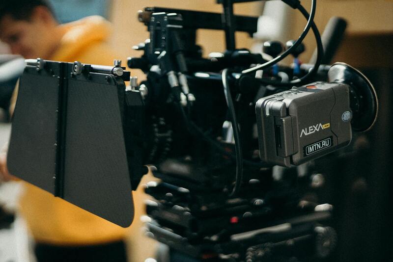
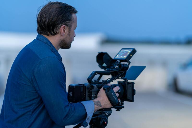
Efficient and high-quality aerial real estate imagery relies on a range of specialized equipment designed to deliver sharp, stable, and detailed visuals. The core tools include various types of drones equipped with advanced camera systems capable of capturing high-resolution images and smooth video footage. Multirotor drones, featuring four or more rotors, are the most common choice for real estate professionals due to their maneuverability and ability to hover precisely, making them ideal for capturing specific property features from different angles and heights.
Fixed-wing drones are also gaining popularity in aerial real estate photography. They are capable of covering larger distances and maintaining longer flight times, which is particularly useful when capturing expansive landscapes or multiple properties within a single shoot. Their aerodynamic design allows for efficiency in flight, enabling real estate agencies to acquire comprehensive aerial coverage efficiently.
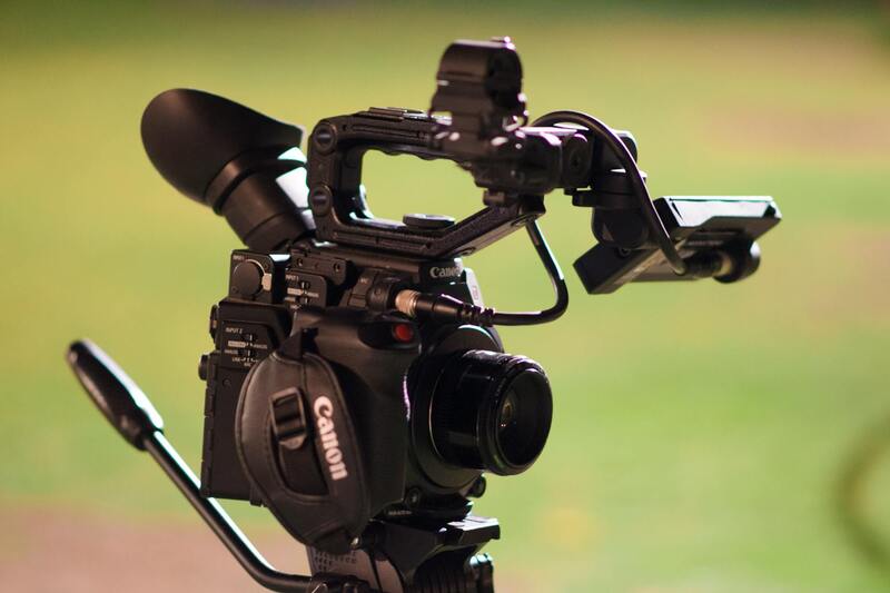
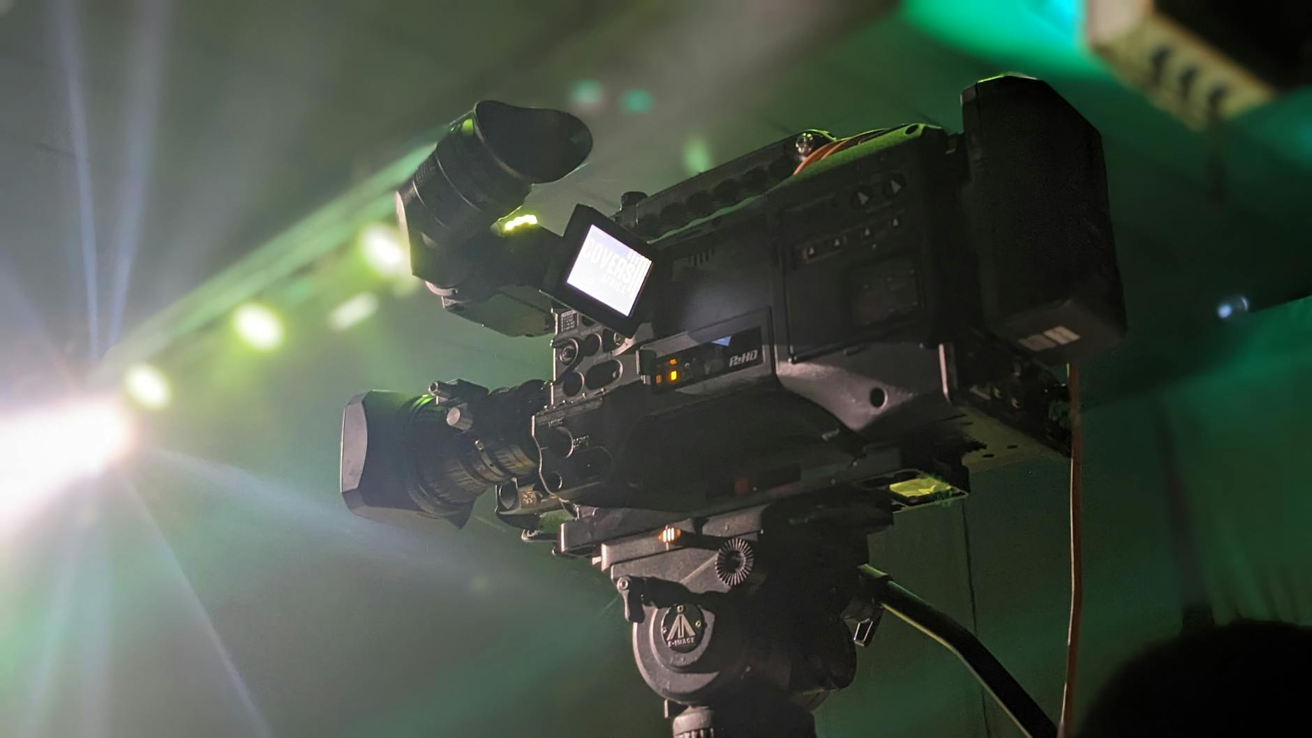
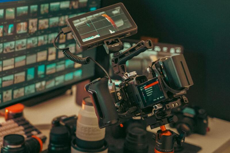
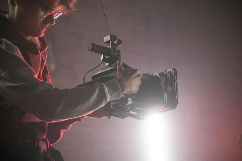
Camera technology plays a critical role in the quality of the final images. Many drones are fitted with gimbaled cameras that ensure stability during flight, eliminating motion blur and allowing for crystal-clear, detailed shots. These cameras often feature wide-angle lenses, high dynamic range (HDR) capabilities, and the ability to shoot in various formats to cater to different marketing needs.
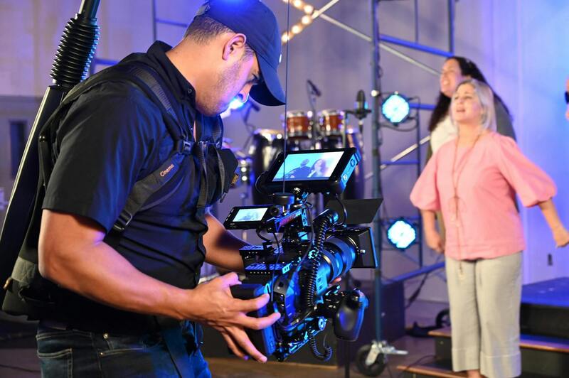
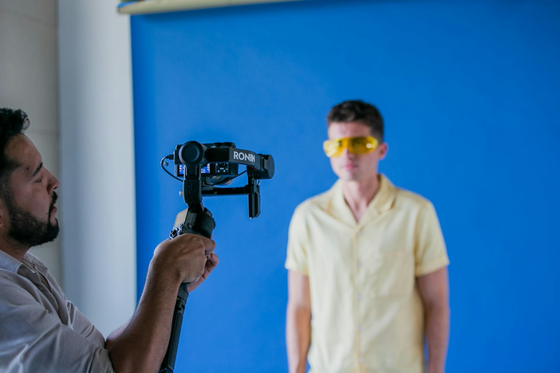
In addition to drones, ground-based stabilization systems such as mobile gimbal rigs and specialized camera mounts can be employed for capturing supplementary angles and ground-level shots that complement aerial imagery. Consequently, a combination of aerial and ground-based equipment provides a comprehensive visual presentation of properties.
Choosing the right equipment involves assessing the property size, terrain, and desired imagery quality. For Miami real estate, which often involves waterfront properties, luxury estates, and large developments, investing in high-end drone models with advanced stabilization and imaging capabilities ensures the production of compelling visuals that stand out in competitive markets. Collaborating with professional aerial photography crews equipped with the latest technology guarantees consistent, high-quality output—an essential factor in effective real estate marketing campaigns.
Types of Aerial Equipment Used in Real Estate Photography
When it comes to capturing compelling aerial images of properties, the selection of equipment plays a crucial role in achieving high-quality results. Different tools are suited to various property types and shooting conditions, each offering unique advantages and limitations that influence the final visual outcome.
**Drones** are the most popular and versatile equipment for aerial real estate photography. Modern professional-grade drones are equipped with high-resolution cameras, GPS stabilization, and advanced flight modes that facilitate precise movements and smooth footage. They are ideal for most residential and commercial properties due to their cost-effectiveness, ease of maneuverability, and ability to access hard-to-reach areas. For waterfront or expansive estate visuals, drones can be flown at various altitudes to showcase the property's full scope and surrounding landscape.
**Helicopters** and manned aircraft have historically been used for aerial photography, especially for large-scale developments or commercial projects requiring extensive coverage. While they provide exceptional image quality and stability, their operation involves higher costs and logistical coordination. These options are often reserved for landmark properties or developments seeking ultra-high-definition imagery for large-format marketing materials.
**Fixed-wing aircraft** are less common in urban environments but can be advantageous for capturing large properties or regional landscapes where longer flight times and wider coverage areas are necessary. They typically require more space for takeoff and landing and involve more complex operation procedures.
**Ground-based stabilization systems**, such as mobile gimbal rigs and camera mounts, are used to complement aerial shots by capturing ground-level and auxiliary angles. These systems ensure that high-quality images are obtained even in challenging conditions, adding depth and perspective to the overall property presentation.
Choosing the appropriate equipment depends on various factors such as the size of the property, its surroundings, and the specific marketing goals. For Miami's diverse real estate market, which features luxury waterfront estates, expansive developments, and urban lofts, leveraging a combination of the latest drone technology with supplementary ground footage creates a comprehensive visual story that appeals to prospective buyers.
Partnering with experienced aerial photography providers ensures access to capable equipment, well-trained operators, and the technological expertise necessary to produce stunning visuals that elevate property marketing efforts. These professionals evaluate the specifics of each project to select the best tools and techniques, resulting in imagery that highlights the property's unique features and helps it stand out in competitive markets.
Legal and Licensing Aspects for Aerial Photography in Miami
Successfully capturing aerial imagery of real estate in Miami requires adherence to a structured set of procedures designed to ensure safety, compliance, and optimal results. Engaging with certified professionals is essential, as they possess the expertise to navigate the city's regulatory environment efficiently. These professionals are well-versed in authorization processes, equipment operation protocols, and safety standards, which collectively help in avoiding disruptions during shoots and ensuring smooth project execution.
Before conducting any aerial photography, a comprehensive planning phase is critical. This involves securing the necessary permits and authorizations from relevant authorities such as the Federal Aviation Administration (FAA), local government agencies, and property owners. Permission from property owners ensures that shots are taken with clear consent, respecting privacy and property rights, which is fundamental in urban and suburban settings alike.
Obtaining permits typically involves submitting detailed flight plans that specify the location, altitude, and duration of drone operations. These plans must align with Miami's specific regulations, including restrictions near airports, heliports, government facilities, and certain urban zones. For instance, Miami International Airport's proximity necessitates additional coordination to prevent interference with air traffic, especially when operating larger or more sophisticated aviation tools.
In addition, operators should be aware of temporary flight restrictions (TFRs) that might be in effect for events or emergencies, as these can alter permissible flight zones on short notice. Collaborating with experienced aerial photography providers who continuously monitor local airspace conditions helps in maintaining compliance and ensuring that all flights are both safe and lawful.
Technical licensing is equally important. Drone pilots engaged in commercial real estate imagery should hold valid certifications from recognized authorities. These certifications verify their training in safe and responsible operation, as well as their understanding of complex airspace regulations. Insurance coverage is another crucial aspect, protecting against potential liabilities that may arise during flight operations or post-production processes.
When selecting an aerial photography partner in Miami, clients should ensure the provider maintains up-to-date certifications and possesses all necessary permits. This not only guarantees the quality and legality of the imagery produced but also reduces potential delays or legal complications that could arise from unapproved operations.
By strictly following the established procedures and regulations, real estate professionals can showcase properties through captivating aerial visuals while upholding the standards necessary for a professional and compliant marketing strategy. This disciplined approach creates a foundation of trust and reliability, making it possible to focus on crafting compelling visual narratives that attract prospective buyers and elevate the property’s market positioning.
Official Certification and Certification Processes for UAS Operations in Real Estate
To ensure the highest standards in aerial real estate photography, industry professionals must obtain specific certifications that validate their skills and knowledge of UAS operations. In Miami, drone pilots engaged in commercial imaging activities should hold certifications issued by recognized authorities such as the Federal Aviation Administration (FAA). These certifications, often called Part 107 certifications, demonstrate proficiency in operating unmanned aircraft safely and responsibly, adhering to prescribed operational guidelines.
Maintenance of current certification is essential, as it involves ongoing education to stay updated on changing regulations, technological advancements, and best operational practices. Certified pilots must also participate in periodic training sessions and safety reviews, assuring clients of their commitment to professionalism.
Alongside certifications, personnel should undertake comprehensive training courses focused on aerial photography techniques, safety protocols, and airspace management. These programs provide insights into optimal planning, execution, and post-flight procedures, especially important when capturing properties from altitudes and angles that enhance marketing appeal.
Obtaining the proper permits from Miami's aviation authorities forms a core component of legal aerial photography. These permits typically include flight authorizations that specify permissible airspace zones, times of operation, and other operational limitations. Ensuring compliance with these parameters prevents disruptions and fosters a seamless content creation process.

Legal and Licensing Aspects for Aerial Photography in Miami
Operating aerial real estate photography in Miami requires adherence to a structured set of procedures that ensure all activities are formally authorized and conducted with regard to prevailing standards. Essential to this process are the permits obtained from relevant authorities, which specify the designated airspace zones, allowable operating hours, and specific operational restrictions. These permits are typically issued following an application process that details the intended flight paths, altitude limits, and safety measures. Securing such authorization guarantees that aerial shoots align with official guidelines, facilitating a smooth and uninterrupted content creation process.
In addition to permits, comprehensive planning for aerial shoots includes verifying that all equipment used conforms to rigorous safety standards. This involves regular maintenance, calibration, and inspection of drones or aircraft to ensure reliable performance during operation. Certified operators overseeing these flights must also enforce strict adherence to established flight protocols, ensuring their activities are both precise and responsible.

Insurance coverage constitutes another pivotal component when engaging in aerial photography. Adequate policies are established to cover possible liabilities arising from property damage, equipment failure, or unforeseen accidents, providing a layer of security for clients and operators alike. Working with professionals who prioritize these official protocols fosters confidence in the overall process, assuring that the resulting imagery is captured within a framework of recognized standards.
Furthermore, operators must remain informed about evolving regulations related to drone operations and airspace management, particularly within a dynamic urban landscape like Miami. Regular updates and ongoing training are vital to keep pace with any modifications that could impact flight permissions or operational procedures.
Ultimately, a strict focus on official licensing and operational compliance creates a foundation of professionalism that elevates the quality and credibility of aerial real estate photography. Clients who engage certified and authorized service providers benefit from content that not only meets industry standards but also highlights properties in the most compelling and compliant manner possible.
Legal and Licensing Aspects for Aerial Photography in Miami
Executing aerial real estate photography within Miami requires adherence to a structured framework that governs drone operations, airspace management, and data collection. Agencies specializing in aerial imagery must secure the necessary authorizations before conducting shoots—these include operational permits, flight clearances, and adherence to airspace restrictions. Such procedures are designed to ensure that aerial imaging activities are carried out smoothly, efficiently, and in compliance with local and federal guidelines.
Securing appropriate permits involves submitting detailed flight plans, specifying the scope of work, and providing evidence of proper safety measures. These documents help authorities assess potential risks and ensure that the operations do not interfere with other airspace users or public safety. Conducting pre-flight planning in consultation with Miami's aviation authorities minimizes disruptions and enhances the quality of the final imagery.
Furthermore, drone operators are required to hold specific certifications that validate their expertise and knowledge of flight protocols. These certifications include understanding and navigating Miami’s airspace regulations, which are subject to ongoing updates. Continual education about evolving operational standards, new regulations, and technological advancements ensures that drone operators remain compliant and capable of executing high-quality aerial captures.
Insurance coverage plays a pivotal role in safeguarding against unforeseen events. Comprehensive policies are essential to mitigate risks related to property damage, equipment failure, or operational mishaps. Working with licensed professionals who prioritize safety and regulatory compliance provides peace of mind during the shoot, enabling focus on capturing the most compelling images of Miami's real estate.
Adhering to these established procedures not only preserves operational integrity but also upholds the professionalism expected in the real estate sector. As Miami continues to evolve as a hub for property development, maintaining rigorous adherence to official standards supports sustainable industry growth and fosters client confidence in aerial marketing strategies.
Legal and Licensing Aspects for Aerial Photography in Miami
Executing aerial real estate photography in Miami requires adherence to structured protocols designed to ensure safe and efficient operations. Operators must secure relevant flight authorizations and adhere to established permit processes governed by regional aviation authorities. This involves submitting comprehensive flight plans that detail the intended flight paths, altitudes, and operational hours, which helps coordinate with air traffic management and avoid conflicts with other aerial activities.
Furthermore, drone pilots are expected to possess valid certifications that demonstrate their proficiency in operational safety and regulatory compliance. These credentials typically include completed training on drone flight safety protocols, understanding of Miami’s airspace classifications, and knowledge of local operational restrictions. Continuous education and staying updated with the latest regulations are vital, as airspace rules evolve to accommodate safety and technological advancements.

Securing appropriate insurance coverage is a fundamental aspect of professional aerial photography. Comprehensive policies address potential liabilities connected to property damage, accidental equipment failure, or unforeseen operational disruptions. These safeguards are critical in navigating the complexities of aerial work, especially within densely populated urban environments like Miami where flights typically encompass high-value properties and sensitive areas.
Engaging with licensed and insured professionals not only ensures adherence to official protocols but also reinforces a commitment to safety and quality. Such partnerships facilitate smoother approval processes and minimize operational risks, providing clients with confidence in the reliability and legitimacy of the imaging process. This meticulous approach underscores the professionalism required in high-stakes real estate marketing, where polished imagery can significantly influence property perception and marketability.
When selecting an aerial photography service, it is crucial to verify that the provider complies with all regulatory and licensing standards. Due diligence includes reviewing certifications, permits, and insurance certificates, as well as assessing their operational experience. Engaging seasoned professionals familiar with Miami’s specific airspace constraints ensures high-quality results while maintaining compliance with all operational requirements.