Overview of Drone Real Estate Footage
Drone real estate footage has revolutionized the way properties are showcased to potential buyers and investors. By utilizing unmanned aerial vehicles (UAVs), real estate professionals can capture stunning aerial views that provide a comprehensive perspective of a property’s layout, surroundings, and unique features. This method of filming elevates property listings, making them more engaging and visually compelling than traditional photography or ground-level videos. Especially in a vibrant market like Miami, where waterfronts, lush landscapes, and sprawling estates define the local real estate scene, drone footage offers a distinct advantage in presenting properties in their best light.
Drone footage enables the visualization of entire properties and their environments in a single, sweeping shot. This comprehensive view can include neighboring amenities, access roads, green spaces, and proximity to beaches or city centers—elements that significantly influence buyers’ decisions. High-quality aerial videos and images can be incorporated into online listings, virtual tours, and social media marketing campaigns, helping listings stand out amid a crowded market.

Demonstrating the expansive potential of drone technology, real estate agents and developers leverage these visuals to tell compelling stories about properties. Whether showcasing a luxury estate overlooking the ocean or a property nestled within vibrant urban neighborhoods, drone footage provides a dynamic perspective unmatched by traditional methods. In a competitive market like Miami, where buyers value both aesthetics and comprehensive insights into a property, integrating drone footage becomes an essential component of effective marketing strategies.
Furthermore, the growing depreciation of traditional media’s impact on prospective buyers underscores the importance of advanced visual presentation techniques. Aerial footage not only enhances listings but also reinforces a property’s prestige and appeal. It captures the full scope of a property’s assets, including land size, outdoor features, and accessibility—key factors influencing market value. High-resolution drone videos and images serve as powerful tools to elevate a property’s online visibility and attract a broader audience.
As the Miami real estate market continues to thrive, the strategic use of drone footage has become a standard in property marketing. Real estate professionals, developers, and photographers recognize that the visual storytelling enabled by drone technology not only attracts attention but also provides a competitive edge. In essence, drone real estate footage is no longer an optional add-on but a fundamental aspect of modern property promotion, especially within a market as dynamic and visually driven as Miami.
Legal and Regulatory Considerations in Miami
Deploying drone technology for real estate in Miami involves adherence to specific guidelines that govern aerial operations within the city. These regulations are designed to ensure responsible drone use, maintain public safety, and protect privacy rights. Professionals aiming to capture drone real estate footage must familiarize themselves with the local airspace rules and obtain necessary permissions prior to flight operations.
Before initiating drone shoots, operators should verify no-fly zones, especially around sensitive areas such as airports, government buildings, and densely populated regions. Miami's urban landscape presents unique challenges, requiring meticulous planning to avoid restricted airspace. Engaging with authorized agencies or consulting with experienced drone service providers can facilitate smooth compliance with these regulations.
Operational protocols typically include maintaining safe distances from people and property, flying within line of sight, and adhering to altitude restrictions. Additionally, drone operators must ensure their equipment is properly registered and their pilots are certified according to the standards set by aviation authorities. Incorporating these practices not only ensures legal compliance but also enhances the professionalism and safety of drone filming efforts.
In Miami, permits may be required for commercial drone operations, especially for extensive or high-profile filming projects. Working with licensed aerial videographers familiar with local regulations streamlines the process and mitigates potential risks. By proactively addressing these regulatory considerations, real estate agents and developers can leverage drone footage effectively while safeguarding their investment and reputation.
Official Methods for Capturing Drone Real Estate Footage in Miami
When acquiring drone real estate footage in Miami, it is essential to adopt official methods that ensure both the quality of the footage and adherence to established standards. These methods encompass comprehensive planning, proper authorization, and adherence to best operational practices designed to maximize safety and effectiveness.
One of the primary steps involves establishing clear flight objectives aligned with the property’s unique features and marketing goals. Detailed pre-flight planning should include a thorough review of Miami’s airspace restrictions, such as those around sensitive zones, to avoid inadvertent violations. Consulting with local drone service providers who are well-versed in Miami’s specific regulations ensures a seamless process.
Secure proper authorization through the designated channels. While there are no explicit mentions of formal permits here, engaging with recognized agencies or licensing entities for drone operations helps streamline compliance. This partnership often involves demonstrating that the drone operator holds current certification, such as a Remote Pilot Certificate, and that the equipment conforms to operational standards.

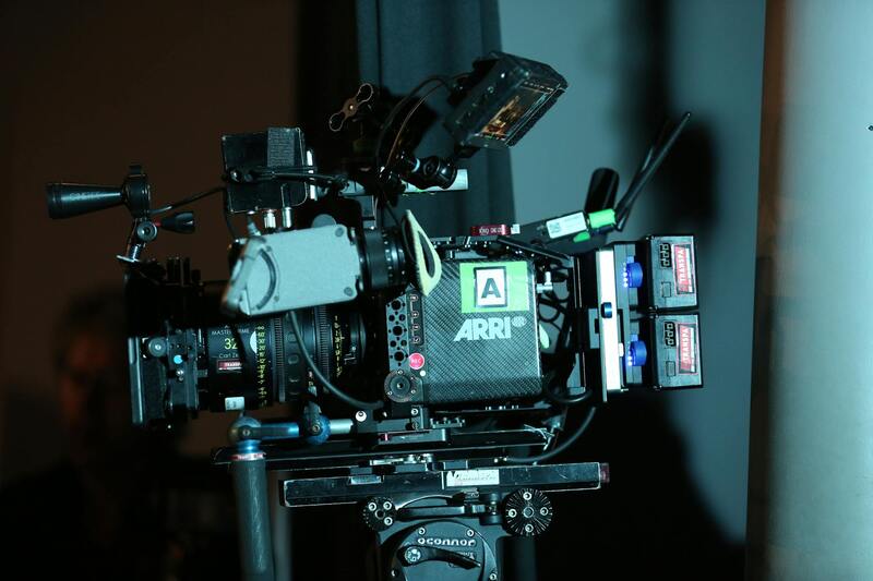
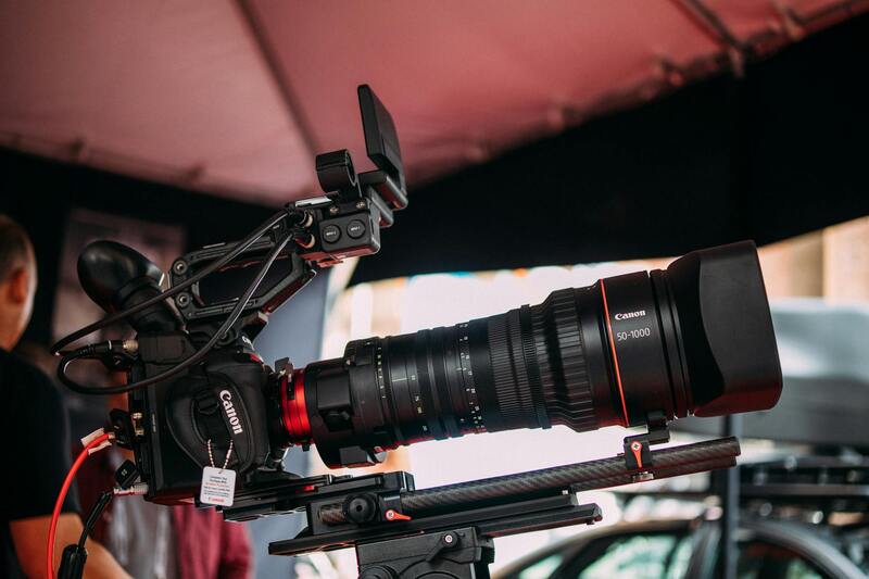
Utilizing professional-grade equipment is another official method to ensure footage quality. High-resolution cameras, stabilized gimbals, and well-maintained drones drastically enhance visual clarity and smoothness, which is critical for appealing real estate presentations. Additionally, adhering to flight protocols — such as maintaining line of sight, managing safe distances from structures and people, and respecting altitude restrictions — guarantees operational safety and compliance.
Operators should also document their flight operations meticulously, including flight paths, times, and safety checks. This record-keeping not only assists in accountability but can be useful for demonstrating adherence to standards when required.
Collaborating with Certified Drone Professionals
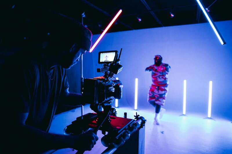
Engaging licensed and experienced drone professionals is often the most effective method for capturing legitimate and top-tier real estate footage in Miami. These experts possess in-depth knowledge of local airspace regulations and operational best practices, which minimizes risks associated with unauthorized or risky flights.
Collaborations with certified drone service providers also facilitate access to advanced equipment and editing capabilities, resulting in footage that is both visually impressive and compliance-oriented. Working with seasoned professionals ensures that the footage produced aligns with industry standards and enhances the property’s marketing appeal.
By choosing reputable providers, real estate firms and agents benefit from a streamlined process where logistical and regulatory concerns are managed proactively. This partnership not only results in compelling visual content but also protects the client’s reputation by avoiding potential operational issues.
Ensuring Proper Operational Procedures for Drone Real Estate Footage
When capturing drone real estate footage in Miami, adhering to structured operational protocols is vital for obtaining high-quality visuals while maintaining safety standards. This involves comprehensive planning prior to each flight, which includes assessing the specific requirements of the property, environmental conditions, and optimal flight paths. Utilizing pre-flight checklists helps ensure all equipment functions correctly, batteries are charged, and firmware is up-to-date, reducing the likelihood of technical issues during the shoot.
Operators should also establish clear flight boundaries to avoid infringing upon private properties or restricted zones, utilizing geo-fencing tools integrated into modern drone systems. These tools assist in automatically preventing flights into unauthorized areas, supporting responsible operational practices. Additionally, setting appropriate flight altitudes and angles enables capturing comprehensive property visuals while respecting overhead restrictions.
During flight, maintaining line-of-sight with the drone and continuously monitoring its position ensures precise control and safety. Using live feed video allows for dynamic adjustments to camera angles and flight paths, optimizing the visual impact of the footage. Recording detailed operational data, such as flight times and specific routes, supports documentation and review, ensuring consistency and accountability in the production process.
Post-Flight Procedures and Data Management
After completing each drone session, proper post-flight procedures are essential. This includes safe drone retrieval, data transfer, and storage of footage in secure locations. Reviewing footage on-site allows for immediate assessment and potential retakes, enabling refinements in coverage and shot composition. Maintaining organized records of all media files and flight logs facilitates efficient editing workflows and adheres to industry best practices.
Data management extends to version control and backup strategies, guaranteeing that footage remains protected against loss or corruption. Properly cataloged media also simplifies the process of integrating drone visuals into various marketing materials, such as virtual tours, online listings, and promotional videos.
Partnering with Certified Drone Professionals in Miami
Engaging with licensed drone operators offers a strategic advantage in capturing compelling real estate visuals. Certified professionals possess a thorough knowledge of local airspace management and operational standards, ensuring flights are conducted within regulatory frameworks. Their expertise minimizes potential disruptions and enhances the efficiency of the production process.
Additionally, experienced drone pilots leverage advanced equipment, including high-resolution cameras and stabilization systems, to produce crisp, steady footage that vividly showcases Miami’s properties. Their technical proficiency extends to post-production editing, enabling the creation of polished, market-ready videos that highlight property features and appeal to prospective buyers.
Opting for reputable drone service providers also ensures adherence to safety standards and operational protocols, safeguarding the interests of all parties involved. This partnership fosters a smooth workflow, from initial planning through final delivery, resulting in engaging visual content that effectively elevates the property's market presence.
Adhering to Official Methods for Drone Operations in Miami
To ensure that drone real estate footage is captured in a compliant and responsible manner, professionals and property marketers rely on established and verifiable approaches. These include working exclusively with licensed drone operators who follow approved flight protocols, maintain current permits, and utilize certified equipment. Engaging with these qualified specialists guarantees that all aerial visuals are obtained through methods recognized by local authorities and industry standards.
Furthermore, employing drones equipped with professional-grade cameras and stabilization technology is fundamental for producing high-quality footage. These aircraft often come with advanced navigation and safety features, such as geofencing and obstacle detection, which assist pilots in executing precise maneuvers within designated airspace. This technological integration ensures the integrity of shots while maintaining safe practices during all phases of flight.
In addition, comprehensive pre-flight planning is an essential component of official drone utilization. This process entails detailed site assessments, understanding airspace restrictions, and coordinating with local authorities where necessary. Such planning minimizes disruptions and guarantees that aerial shots are obtained smoothly without infringing on protected zones or creating hazards.
Documenting and adhering to operational logs and flight records reinforces a streamlined workflow and facilitates auditing or review processes. This practice, combined with continuous pilot training on updated regulations, upholds the standards that support responsible drone usage in the Miami real estate market.
Utilizing Permitted Airspace and Air Traffic Coordination
When conducting real estate drone flights, professionals prioritize authorized airspace and coordinate with Miami’s air traffic management entities. This collaboration ensures that aerial filming does not interfere with public air operations and that safety remains paramount. By obtaining necessary permissions, such as flight clearances or notices of aerial activity, drone operators demonstrate adherence to official procedures that govern aerial activities within urban environments.
Moreover, focusing on permitted zones—such as private property with permission or specifically designated areas—minimizes the risk of unintended disruptions. The use of official flight paths and adherence to prescribed altitude limits further aligns the execution of drone footage with established guidelines, facilitating high-quality visual content within authorized boundaries.
Adopting official methods significantly enhances the professionalism and reliability of drone-based real estate marketing. It embodies a commitment to responsible aerial filming that respects regulatory standards, promotes safety, and produces compelling visual content tailored to the dynamic Miami real estate landscape.
Best Practices for Shooting Drone Real Estate Videos
Producing high-quality drone footage for real estate purposes requires meticulous planning and execution, grounded in structured operational procedures. To achieve optimal results, professionals should prioritize comprehensive pre-flight planning. This includes reviewing weather conditions, assessing lighting during different times of the day, and selecting appropriate flight paths that highlight the property’s unique features. Clear objectives, such as showcasing curb appeal, property layout, or surrounding amenities, guide the drone’s movements and camera angles to produce impactful visuals.
Communication plays a pivotal role during drone flights. Establishing a clear flight plan with team members or property owners ensures everyone understands the scope and sequence of the shoot. Maintaining visual line of sight at all times ensures precise control over the drone, facilitating smooth maneuvering around obstacles and capturing stable footage. Using GPS-assisted flight modes enhances precision, especially in complex environments, thereby delivering steady and professional shots.

In busy urban areas like Miami, observing specific altitude restrictions and avoiding densely populated zones minimizes unnecessary risks and ensures compliance with spatial guidelines. Drones should be operated at altitudes that maximize the visual impact of the property without encroaching on prohibited airspace. Employing obstacle avoidance technology is essential to prevent accidents, especially when navigating around tall structures or trees.
Adjusting camera settings during flight, such as shutter speed, ISO, and focal length, allows capturing sharp and vibrant images that align with the property’s aesthetic appeal. Additionally, capturing footage during golden hours—shortly after sunrise or before sunset—can dramatically enhance the visual quality and emotional resonance of the videos.
Post-flight review and data management are critical to maintaining a high standard of content. Immediately reviewing drone footage allows for the identification of any issues, such as motion blur or framing errors, enabling timely retakes if necessary. Proper storage of footage in secure, organized repositories facilitates seamless editing processes and ensures easy access for marketing campaigns.
Adhering to these official guidelines not only improves the visual quality of real estate videos but also reinforces a reputation for professionalism. A strategic approach to drone footage cultivation ensures that each shot effectively communicates the property’s value, attracts prospective buyers, and aligns with marketing goals that respect operational standards and safety protocols within Miami’s vibrant urban landscape.
Best Practices for Shooting Drone Real Estate Videos
Executing professional drone real estate footage requires adherence to structured shooting protocols that maximize visual appeal while maintaining safety and operational efficiency. A systematic approach begins with comprehensive pre-flight planning, where the designated flight path is mapped out, considering key property features and surrounding environment. This ensures optimal angles and vantage points, capturing expansive views of the estate, neighboring amenities, and attractive landscaping.
Optimal flight altitude is critical; typically, maintaining a height between 50 to 150 feet allows for a broad perspective that encompasses the property's full scope without compromising image quality. Flight paths should be planned to avoid obstructions such as power lines, trees, or tall structures, which could interfere with camera angles or pose safety risks. Employing obstacle avoidance features enhances safety, especially in densely built environments.
Utilizing steady, controlled drone movements cultivates smooth footage. Slow, deliberate panning and altitude adjustments provide viewers with a cinematic experience that highlights both the property’s grandeur and its distinctive features. During filming, maintaining consistent exposure settings, such as ISO and shutter speed, guarantees clear, vibrant visuals free of flickering or motion blur, which are vital for high-quality post-production editing.
Lighting conditions significantly influence the final output. Filming during golden hours—early morning or late afternoon—can deliver warm tones and softer shadows, emphasizing the property's aesthetic appeal. Aerial footage captured under optimal natural light can dramatically elevate the perceived value of a listing.
Post-flight, immediate review of footage is essential. Screening recordings on-site allows for quick identification of issues such as framing errors or technical malfunctions, enabling re-shoots if necessary. Sorting files into organized, secure storage systems streamlines subsequent editing processes.
Moreover, incorporating multiple shooting passes from different angles and altitudes enriches the visual narrative, offering potential buyers a comprehensive understanding of the property’s layout, surroundings, and unique features. Professional drone operators should pay close attention to maintaining regulated flight altitudes and distances, respecting designated airspace boundaries and avoiding intrusive or overreaching shots that could compromise the professionalism of the marketing material.
In addition, leveraging camera stabilization equipment and gimbals enhances footage fluidity, especially during complex maneuvers or windy conditions. This refinement results in smooth, polished videos that more effectively communicate the quality of the property to prospective clients.
Legal and Regulatory Considerations in Miami
To produce high-quality drone real estate footage in Miami, understanding and complying with the local airspace regulations and ordinances is essential. Miami’s vibrant real estate market benefits from aerial imagery, but operators must navigate the established frameworks governing unmanned aircraft operations. Adhering to these standards not only ensures smooth filming sessions but also protects the interests of clients and the integrity of marketing materials.
Operators should familiarize themselves with the specific flight restrictions within Miami-Dade County. Certain areas, such as near airports, government facilities, or other sensitive zones, may have designated no-fly zones or require special permissions. It’s vital to consult official resources or coordinate with local authorities for designated flight plans, especially when aiming to capture footage over private properties or crowded neighborhoods.
Utilizing certified drone pilots who are well-versed in Miami’s flying regulations can mitigate risks associated with inadvertent violations. Certified professionals possess the necessary knowledge of flight restrictions, permissible altitudes, and safe operation practices. They also keep abreast of any updates or changes to the local policy framework, which can be influenced by urban development initiatives or new security measures.
Planning flight missions with detailed pre-flight checklists, including securing authorization letters and understanding restricted zones, complements compliance efforts. Additionally, employing geofencing technology or automatic restrictions on drones can prevent accidental incursions into prohibited airspace, supporting responsible aerial operations.
In terms of data handling, all footage captured must be stored securely and managed according to best practices, especially when handling sensitive property visuals. This approach not only maintains professional standards but also builds confidence among clients regarding data confidentiality and security.

Overall, working within legal and regulatory boundaries enhances the efficiency and success of drone real estate marketing efforts in Miami. It creates a foundation for ongoing aerial campaigns, allowing real estate professionals and drone operators to focus on capturing compelling visuals that elevate property listings without concerns over compliance issues. When executed properly, this approach contributes to a more professional, polished presentation that resonates with prospective buyers and stakeholders in this competitive market.