Overview of Drone Services in Real Estate
In recent years, drone technology has revolutionized the real estate industry, particularly in vibrant markets like Miami. These aerial platforms enable real estate professionals to capture striking, high-quality images and videos from perspectives that were previously difficult or costly to achieve. The seamless integration of drone services into property marketing strategies has increased visibility and engagement, helping listings stand out in competitive environments.
The adoption of drone technology is driven by its ability to provide comprehensive visual storytelling. Prospective buyers gain a better sense of property layout, surrounding amenities, and neighborhood context through dynamic aerial footage. Not only does this elevate the attractiveness of property listings, but it also streamlines the property viewing process by offering virtual tours that save time and resources.
In Miami, a city renowned for its luxurious real estate, waterfront properties, and iconic skylines, drone services have become a staple tool for showcasing property features with stunning clarity and detail. Real estate agents, brokers, and property developers increasingly leverage drones to create engaging marketing materials that drive faster sales and higher property valuations.
Growth in this sector is fueled by advancements in drone technology—such as enhanced camera stabilization, longer flight times, and higher-resolution image capturing capabilities. These improvements allow for more detailed and professional-grade visuals suitable for high-end listings, commercial developments, and new constructions.
Furthermore, the rapid evolution of drone services aligns with the digital marketing trends demanding premium visual content. As property buyers become more reliant on online browsing, high-quality drone footage becomes essential for capturing attention and generating interest.

Legal and Regulatory Considerations
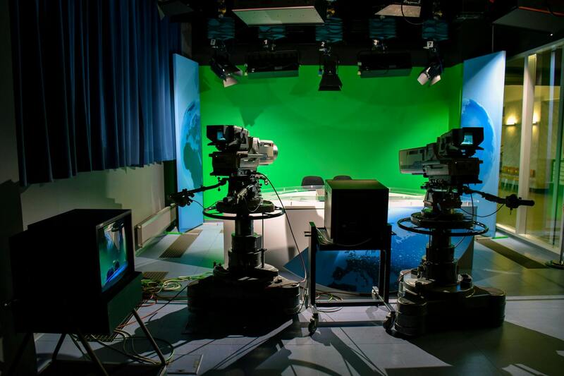
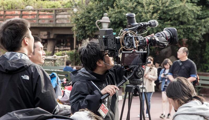
When integrating drone services into real estate marketing strategies in Miami, understanding the established procedures and protocols for drone operations is essential. These procedures are designed to streamline drone usage for commercial purposes while ensuring safety, privacy, and compliance with local guidelines.
In Miami, conducting drone flights for real estate requires adherence to specific operational standards that cover flight altitude restrictions, designated airspace considerations, and operational hours. These standards are often governed by regulations that prioritize the safety of both drone operators and the public.
Many professional drone service providers in Miami implement meticulous planning processes, including obtaining necessary clearances from relevant authorities and verifying that flight paths do not interfere with manned aircraft or sensitive areas. This planning is supported by comprehensive pre-flight assessments and risk management protocols.

For real estate photographers and videographers, employing certified operators with extensive experience in Miami’s specific airspace regulations ensures quality outputs without operational interruptions. They utilize digital tools for flight planning that incorporate real-time weather data, airspace restrictions, and local guidelines, thus enhancing efficiency and reducing the risk of violations.
Furthermore, data protection and privacy policies are critical considerations. High-definition drone footage should be captured with respect for neighboring properties and privacy boundaries, avoiding intrusions into private spaces or sensitive areas. This respect not only aligns with community standards but also fortifies the professional reputation of those offering drone services.
Regulations continue to evolve with technology, making it important for drone operators in Miami to stay updated through official channels and industry associations. Continued education and adherence to these standards ensure sustained lawful operations, safeguarding reputation and avoiding potential disruptions.

Comprehensive Flight Planning and Compliance with Miami Drone Guidelines
Effective utilization of drone services for real estate in Miami begins with meticulous flight planning that respects the specific airspace requirements of the region. These plans account for Miami’s numerous residential neighborhoods, commercial districts, and protected environmental zones. Drone operators must carefully delineate flight paths, ensuring they avoid restricted airspaces such as near airports, heliports, or sensitive wildlife habitats.
Preparation involves integrating real-time weather data to forecast wind speeds, visibility, and other atmospheric conditions that could impact drone safety and image quality. Digital flight planning tools, incorporating Miami's local airspace restrictions, help operators create efficient routes while maintaining compliance with established protocols.
Operators focus on securing permissions required for each flight, particularly over private properties or commercial zones where permissions may be necessary based on project scope. Detailed risk assessments are conducted prior to each flight, considering environmental factors, potential obstacles, and site-specific challenges. These assessments inform safety protocols designed to mitigate potential hazards.
Risk Management and Local Airspace Considerations
Maintaining situational awareness throughout the flight is crucial. Operators utilize multispectral monitoring tools and Digital Elevation Models to identify potential obstructions such as tall buildings, power lines, or communication towers that might interfere with drone operations. Regular updates from local authorities and adherence to Miami's flight height restrictions prevent unauthorized incursions into controlled airspaces.
Pre-flight checks include verifying drone operational status, battery levels, and calibration of systems. During flights, continuous monitoring ensures that the drone operates within safe parameters, avoiding interference with manned aircraft and other aerial activities.
Data Security and Privacy Considerations
Respecting privacy boundaries is a key aspect of drone operations in real estate photography. High-definition footage and images are captured with careful consideration of neighboring properties, avoiding inadvertent intrusion into private spaces. Secure data handling practices ensure that sensitive information remains protected.
Operators should communicate clearly with clients about how footage will be acquired, stored, and used, emphasizing their commitment to confidentiality and respectful filming practices. This transparency fosters trust and aligns with community standards, ensuring seamless integration of drone imagery into marketing materials.
Ongoing Education and Industry Standards
As drone technology evolves, continuous education is necessary to keep workflows aligned with current practices. Industry associations and official channels provide updates on regulations and best practices, which operators incorporate into their routine training sessions.
This proactive approach ensures that drone services remain compliant and capable of leveraging new technological advancements to enhance real estate marketing efforts. With ongoing adherence to these standards, drone operators can provide professional, high-quality imagery that elevates property listings and supports the business growth of real estate professionals in Miami.
Types of Drone Photography and Videography
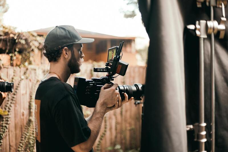
Offering a diverse range of aerial imaging options, drone services for real estate are tailored to meet the specific marketing needs of property listings. High-resolution still photography captures the intricate details of a property’s exterior, highlighting architectural features, landscaping, and surrounding amenities. These images provide a comprehensive visual overview, helping potential buyers evaluate property appeal at a glance.
Videography, on the other hand, allows for dynamic presentations through cinematic flyovers and walkthroughs. These videos can showcase the property's spatial context within its neighborhood, emphasizing proximity to local attractions, schools, and transport links. For upscale listings, 4K video footage adds a layer of sophistication, elevating marketing materials and appealing to discerning clients.
Advanced drone technology supports various specialized imaging techniques such as thermal imaging, which can be utilized to highlight home energy efficiency or identify potential issues with insulation and heating systems. Panoramic shots, 360-degree photos, and virtual reality-ready footage further enrich the property presentation, offering immersive experiences for remote viewers.
Utilizing these varied types of imagery not only enhances online listings but also deepens engagement with prospective buyers. The ability to portray properties from multiple vantage points and in high detail ensures that listings stand out in a competitive market, ultimately accelerating the sales process.
Types of Drone Photography and Videography
In the realm of real estate marketing, utilizing various drone imaging techniques can significantly enhance property presentations. High-resolution aerial photography captures the property's exterior from multiple angles, highlighting landscaping features, architectural details, and overall property size. These still images are essential for online listings, brochures, and social media campaigns, providing potential buyers with a clear visual understanding of the property’s exterior. Cinematic drone videos offer dynamic perspectives, including sweeping flyovers and smooth walkthroughs that bring a property to life. These videos can convey the property's spatial relationships within its neighborhood, such as proximity to parks, commercial centers, and transportation hubs. The fluid movement through a property helps viewers gauge layout, flow, and scale more effectively than static images. Advanced imaging techniques further enrich property marketing. For example, thermal imaging can detect heat loss, identify insulation issues, or highlight energy-efficient features. 360-degree panoramic shots and virtual reality (VR) tours allow prospective buyers to explore properties interactively from remote locations. Such immersive experiences foster deeper engagement and facilitate making informed decisions without physically visiting the property. Utilizing different types of drone footage serves multiple marketing objectives:
- Standard Aerial Photos: Clear, detailed images for online listings and printed materials.
- High-Definition Video Tours: Engaging visuals that showcase property flow and neighborhood context.
- Thermal Imaging: Visual data for energy assessments and maintenance planning.
- Virtual Reality Content: Immersive property exploration that appeals to distant or busy clients.
Types of Drone Photography and Videography
In the realm of real estate marketing, leveraging various drone-based imaging techniques can significantly enhance property presentations. Different types of aerial footage serve unique purposes and appeal to diverse buyer interests, ensuring that both the property and its surrounding environment are showcased optimally.
Standard Aerial Photography
High-resolution aerial photos captured via drone provide crisp, comprehensive views of a property’s exterior. These images are ideal for online listings, brochures, and marketing campaigns, offering potential buyers an instant understanding of the property's size, layout, and landscape features. Strategic use of lighting and optimal flying angles ensure that each image highlights key selling points and enhances visual appeal.
High-Definition Video Tours
Moving beyond static images, HD drone videos create engaging walkthroughs that illustrate the flow of interior spaces and the relationship between indoor and outdoor areas. Dynamic flyovers and smooth tracking shots give viewers a sense of movement, allowing them to visualize themselves in the space. Including neighborhood footage, such as nearby parks or commercial centers, adds context that can influence purchasing decisions.
Thermal Imaging
Thermal imaging captures heat signatures that reveal structural and energy efficiency details of a property. This technique is particularly useful for identifying insulation issues, heat leaks, or electrical faults. When incorporated into real estate marketing, thermal visuals can project a property’s energy performance, attracting buyers interested in sustainable or cost-efficient homes.
360-Degree Panoramic Shots and VR Tours
Immersive technology, such as 360-degree photos and virtual reality (VR) experiences, enables prospective buyers to explore a property remotely. These interactive tours simulate walking through the space, providing a comprehensive understanding of layout, room dimensions, and spatial relationships. This method is especially advantageous for out-of-town clients or during initial property assessments, enhancing engagement without physical visits.
Utilizing an array of drone imaging techniques ensures a versatile and compelling property presentation. Incorporating these visuals into a customized marketing strategy allows real estate professionals to stand out in competitive markets, increasing the likelihood of attracting serious buyers and accelerating sales timelines.
Legal and Regulatory Considerations
When deploying drone services for real estate, understanding the framework governing drone operations is essential. Ensuring that drone flights adhere to prescribed guidelines protects the integrity of the marketing process and maintains a company's professional reputation. Operators must familiarize themselves with specific airspace classifications, designated no-fly zones, and restrictions around sensitive areas such as airports, government buildings, and military installations. These parameters are established based on national and local drone regulations to facilitate safe and responsible drone usage.
It is equally important to conduct pre-flight assessments to identify potential hazards, such as tall structures, power lines, or dense foliage, which could interfere with drone operation. Regulatory bodies often require drone operators to complete certification courses or attain licenses that verify their competency in managing unmanned aircraft under various conditions. Moreover, maintaining detailed flight logs and obtaining necessary permits for commercial drone usage form part of a professional approach to integrating drone imagery into real estate marketing efforts without interruption.
Operational planning should also include considerations for privacy, ensuring drone flights respect the rights of individuals and comply with privacy laws. Communicating with property owners and neighbors prior to drone flights fosters transparency and avoid misunderstandings. Employing authorized drone service providers familiar with current laws and regulations guarantees a smooth integration of aerial visuals into property marketing campaigns, avoiding potential legal complications and emphasizing a professional approach to showcasing properties.
Types of Drone Photography and Videography
Various imaging techniques are available to maximize the visual appeal of a property listing. Wide-angle shots capture the entire facade and surrounding landscape, giving potential buyers a comprehensive exterior view. For interior shots, stabilized drone-mounted cameras can deliver smooth, high-quality images of spacious rooms and architectural details.
Video tours, often complemented by cinematic drone footage, create dynamic walkthroughs that immerse viewers in the property. These videos can highlight property features such as expansive yards, swimming pools, or unique architectural elements from multiple angles, enhancing the property's desirability.
- High-Resolution Photos
- Full Motion Videography
- Time-Lapse Sequences
- Sunrise or Sunset Shoots for Dramatic Lighting
- Infrared and Thermal Imaging
Benefits for Real Estate Agents and Sellers
Incorporating high-quality aerial imagery significantly enhances property marketing. Drones enable comprehensive visual coverage, revealing property details that traditional photography might miss. From capturing the full extent of a landscaped yard to showcasing architectural nuances, drone visuals create a lasting impression on prospective buyers.
The rapid turnaround of aerial content ensures listings stay current and engaging, which is critical in competitive markets. Enhanced visuals also facilitate virtual tours, allowing remote buyers to experience the property authentically. This broader reach attracts a diverse pool of potential buyers, including those relocating from out of town or overseas.
Furthermore, drone footage adds a professional touch to marketing materials, elevating the listing’s reputation and attracting higher-quality inquiries. The vivid imagery often translates into faster sales, reduced days on market, and potentially higher sale prices, benefiting both sellers and real estate professionals.
Investment and Cost Considerations
The cost of drone services can vary depending on factors such as the complexity of shots, the duration of flights, and the level of post-production editing required. While initial investments may seem substantial, the value delivered through captivating imagery often justifies the expense. High-quality drone videos and photos can be used across various marketing channels—MLS listings, social media, websites, and print materials—maximizing return on investment.
For real estate agents and sellers, understanding the scope of services and associated costs allows for better budget planning. It’s advisable to obtain multiple quotes from reputable drone service providers, ensuring they provide transparent pricing, detailed project scope, and examples of previous work. This diligence guarantees access to professional-grade imagery that can significantly elevate property marketing efforts without unforeseen expenses.

Future Trends in Drone Real Estate Applications
As technology continues to advance, the scope and sophistication of drone applications in real estate are expected to expand significantly. Innovations such as autonomous flight paths, real-time data integration, and enhanced imaging capabilities will enable real estate professionals to offer more dynamic and interactive viewing experiences. These developments will streamline the property showcase process, making it easier for potential buyers to explore properties remotely with unprecedented clarity and detail.
Another noteworthy trend is the integration of drones with virtual reality (VR) and augmented reality (AR) platforms. This combination will provide immersive property tours, allowing prospective buyers to virtually walk through homes and neighborhoods from anywhere around the world. Such immersive experiences can lead to increased engagement, faster decision-making, and broader market reach.
Furthermore, advancements in sensor technology and high-resolution imaging will allow drones to capture more detailed data about properties, including structural features, environmental conditions, and landscape quality. This data can be invaluable for property assessments, renovation planning, and environmental compliance checking, providing a comprehensive marketing and analytical toolset for real estate professionals.
Additionally, the development of automated flight planning and artificial intelligence (AI) integration will optimize drone operations, reducing the need for manual control and enabling more consistent, efficient data collection. For real estate agents and developers, this means faster turnaround times, more precise data, and an expanded toolkit for presenting properties in the most compelling way possible.
Environmental sustainability and energy efficiency are also set to influence future drone applications. Electric drones with longer flight times and eco-friendly operations will become more prevalent, aligning with green building initiatives and eco-conscious marketing strategies. These sustainable practices not only enhance a developer’s reputation but also appeal to environmentally aware buyers.
In summary, the future of drone services in real estate will be characterized by technological integration, immersive experiences, and data-driven insights. These enhancements will enable real estate professionals to deliver higher-quality marketing campaigns, streamline property assessments, and reach a broader audience, ultimately driving sales and fostering innovation in property presentation techniques.