Overview of Commercial Property Aerial Photography
Commercial property aerial photography has become an essential component in the toolkit of real estate professionals, investors, and developers seeking to showcase and assess properties from a comprehensive perspective. Utilizing high-quality aerial imagery provides a distinct advantage by capturing expansive views of land parcels, building layouts, and surrounding infrastructure that are often difficult to visualize from ground level. This visual approach not only enhances property marketing efforts but also aids in detailed site analysis, environmental assessments, and strategic planning.
In the context of commercial real estate, aerial photographs serve multiple pivotal purposes. They offer a clear and compelling visual narrative that can attract potential buyers, tenants, and investors by highlighting key features such as property size, accessibility, landscape integration, and proximity to major transportation routes. Furthermore, aerial imagery facilitates the identification of potential development opportunities, keeps stakeholders informed about site conditions, and supports project management by providing up-to-date visual documentation.
In a rapidly evolving real estate market like Miami’s, where urban development and commercial expansion are dynamic, aerial photography has emerged as a vital method for professionals to maintain an advantage. It enables clear overviews of large-scale projects, helps pinpoint optimal locations, and improves the accuracy of land measurements and planning efforts. With technological advancements, aerial photography is no longer limited to basic imagery; it now involves sophisticated cameras and drone systems that deliver precise, high-definition images tailored for commercial applications.
The importance of aerial photography extends beyond mere visualization. It is a strategic tool that streamlines decision-making processes, enhances marketing campaigns through captivating visuals, and elevates the overall quality and professionalism of property presentation. As a result, investing in reliable and professional aerial imagery directly impacts the success and efficiency of commercial real estate transactions and development projects in Miami and beyond.
Legal Regulations and Permits in Miami
To ensure high-quality aerial imagery for commercial properties, it is essential to adhere to established procedures and official protocols governing drone operations and aerial photography within Miami. These protocols are designed to harmonize the use of unmanned aircraft systems (UAS) with safety standards, airspace management, and privacy considerations.
Operators must obtain authorization from the Federal Aviation Administration (FAA) by securing necessary exemptions or waivers tailored for commercial drone use. This process involves submitting a comprehensive plan that details the intended flight paths, times, and operational procedures, especially when operating in congested or restricted airspace near urban centers.
In Miami, specific zones such as near airports, government buildings, or densely populated areas may require additional permissions or notifications to local authorities. Local regulations often stipulate guidelines for maintaining safe distances from crowds, sensitive infrastructure, and private properties. Drone pilots should also conduct thorough pre-flight assessments to evaluate potential hazards like wind patterns, interference from tall structures, or electromagnetic areas that may impact drone stability.
Part of the permit process involves proper registration of the drone equipment with the FAA, including ensuring the devices meet the prescribed safety standards and are equipped with geofencing capabilities to avoid no-fly zones. This careful planning and compliance reinforce the professionalism and integrity of aerial photography operations.

Legal Regulations and Permits in Miami
Navigating the landscape of aerial photography in Miami necessitates a comprehensive understanding of the governing regulations at various levels. For commercial property aerial photography, compliance begins with adherence to federal guidelines primarily overseen by the Federal Aviation Administration (FAA). All drone operations must be conducted under the authority of FAA Part 107, which mandates operators to obtain a remote pilot certificate, conduct pre-flight risk assessments, and ensure their equipment meets safety standards. This certification process confirms that operators are knowledgeable about airspace rules, weather considerations, and operational limitations conducive to safe drone flights.
State and local ordinances further shape the parameters for drone use within Miami. Local agencies often have specific restrictions related to flight altitudes, operational hours, and proximity to sensitive locations such as airports, government buildings, and other critical infrastructure. These regulations aim to balance aerial photography benefits with safety and privacy concerns, ensuring that commercial property imagery is collected responsibly.
Obtaining the necessary permits involves submitting flight plans to local authorities when required, particularly for flights involving beyond visual line of sight or operations in controlled airspace. Many service providers facilitate this process, ensuring all permits and notifications are properly handled before the flight. This proactive approach reduces delays and minimizes disruptions, paving the way for seamless aerial surveying of commercial developments.
Moreover, drone operators must register their equipment with the FAA, ensuring that each device is properly documented and equipped with geofencing technology to prevent inadvertent incursions into restricted areas. Such registration not only aligns with legal compliance but also reflects a commitment to safe operational practices.
By integrating these regulatory frameworks into their workflows, aerial photography providers in Miami can deliver high-resolution images that precisely capture commercial properties' specifics without encountering legal or procedural setbacks. This disciplined approach underpins the production of comprehensive visual assets that support real estate marketing, property assessments, or development planning with confidence and professionalism.
Official and Legitimate Methods for Aerial Photography
When conducting commercial property aerial photography in Miami, it is essential to utilize known, verified methods that ensure high-quality results while adhering to established operational standards. The cornerstone of these legitimate approaches involves selecting certified aerial photography providers equipped with professional-grade equipment and technical expertise. These providers typically employ advanced drones and aircraft piloting techniques to deliver clear, detailed images of commercial sites that support various business needs, from marketing to planning.
One primary practice involves thorough planning and execution of aerial surveys using reputable platforms. This process begins with comprehensive site assessments to determine the optimal flight paths and camera settings, ensuring that images capture the necessary details for the client’s objectives. Such preparations are crucial for acquiring precise visuals that accurately represent the commercial property's layout, condition, and surrounding environment.
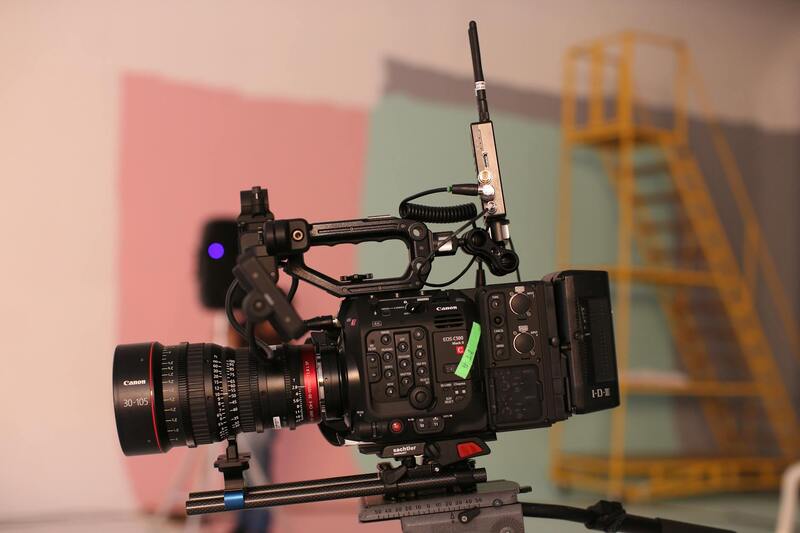
Operators commonly utilize multi-rotor drones with stabilized camera gimbals and high-resolution sensors. These tools allow for stable, detailed captures of expansive properties, even in challenging lighting or weather conditions. Many providers also incorporate specialized techniques such as HDR imaging, which combines multiple exposures to produce images with a high dynamic range vital for detailed analysis.
Ensuring Quality and Data Integrity
Apart from hardware, the use of proven methodologies and post-processing software ensures the resulting imagery meets professional standards. These tools enable color correction, image stitching, and three-dimensional mapping, providing clients with versatile visuals for various applications. For example, orthomosaic maps generated through legitimate aerial photography methods offer precise overhead views that are invaluable for site planning and assessment.
Operational Planning and Safety Measures
Legitimate aerial photography operations involve detailed flight planning to adhere to safety protocols and operational standards. Experienced pilots perform pre-flight risk assessments, establish clear communication channels, and follow designated flight paths to minimize disturbance. They also maintain real-time monitoring during flights to respond promptly to any unforeseen circumstances, ensuring the safety of people, property, and airspace integrity.
Documentation and Reporting
Executing official aerial photography includes meticulous documentation of procedures, flight logs, and imagery data. These records facilitate transparency and traceability, delivering additional confidence to clients and stakeholders. Advanced data management solutions also enable secure storage and efficient retrieval of visual assets for future reference or compliance purposes.
Conclusion
Adhering to acknowledged and credible techniques in commercial property aerial photography ensures high-quality, accurate visual representations of Miami’s extensive real estate developments. Such methods leverage sophisticated equipment, strategic planning, and comprehensive documentation, ultimately resulting in imagery that is both visually compelling and operationally reliable. When engaging with professionals following these practices, clients can confidently leverage aerial visuals to optimize marketing strategies, streamline property evaluations, or facilitate development projects without concern over procedural adherence or image fidelity.
Official Methods for Conducting Commercial Property Aerial Photography in Miami
When it comes to capturing high-quality aerial images of commercial properties within Miami, employing official and well-established methodologies ensures both precision and compliance. These methods are grounded in the use of licensed aircraft operators, trained pilots, and validated technological tools designed for aerial imaging. Such practices guarantee that the imagery obtained meets industry standards for clarity, detail, and spatial accuracy while respecting airspace regulations and property rights.
One fundamental aspect involves meticulous flight planning, which includes detailed mapping of flight paths that encompass the target property and surrounding areas. This planning accounts for optimal angles that highlight key architectural features, landscape elements, and contextual surroundings, which are essential for marketing or analysis purposes. The selection of appropriate times of day—often during peak natural lighting conditions—maximizes image quality and detail capture.
Moreover, the use of certified drone pilots or manned aircraft operators is crucial. These professionals possess valid licenses and certifications that conform to governing standards for unmanned and manned aerial operations. They utilize approved flight corridors and maintain constant communication with air traffic control to ensure safety and operational integrity. Real-time monitoring systems are employed to track flight parameters, weather conditions, and airspace activity, allowing prompt adjustments that prevent any disruption.
Advanced Technologies Supporting Commercial Property Aerial Photography
Official aerial photography methods leverage cutting-edge equipment to produce detailed and reliable images. High-resolution digital cameras mounted on drones or aircraft equipped with stabilized gimbals deliver sharp visuals with minimal distortion. Multi-spectral and thermal imaging devices further enhance the ability to analyze property conditions, assess energy efficiency, or evaluate structural health.
Global Positioning System (GPS) technologies facilitate precise georeferencing of images, allowing seamless integration with geographic information systems (GIS) for spatial analysis. Automated flight planning software optimizes route design and ensures that imagery meets predetermined specifications, reducing errors and improving efficiency.
Post-flight, the secure handling of photographic data is managed through validated storage systems that support rapid retrieval, editing, and sharing. This highly organized approach streamlines workflows, supports collaboration, and maintains a transparent chain of documentation that is essential for ongoing project management.
Legal Regulations and Permits in Miami
Successfully executing commercial property aerial photography in Miami requires adherence to established procedures that govern aerial activities within the city and state. Acquiring the appropriate permits ensures that all operations are conducted responsibly and in accordance with local aviation frameworks. This process involves coordinating with relevant authorities to obtain clearances for drone flights or aircraft operations over specific commercial areas, particularly in densely populated districts or zones with sensitive infrastructure.
When planning aerial photography projects, permits are typically obtained through the Federal Aviation Administration (FAA) at the federal level, complemented by local approvals that address specific Miami regulations. These might include restrictions on flight altitude, designated no-fly zones, and times when aerial activities are permitted. Ensuring that all necessary authorizations are secured before undertaking any flights not only aligns with official standards but also minimizes potential disruptions.
Part of complying with these procedures involves establishing safety protocols and flying within approved parameters. Professional operators often conduct pre-flight assessments to identify potential hazards and to plan routes that avoid conflicts with other airspace activities. Moreover, maintaining clear communication channels with local authorities during operations helps facilitate smooth execution and quick resolution of any unforeseen issues.
Operational diligence extends to adhering to strict data security practices by handling images and related project documentation through secure, validated storage systems. This approach supports efficient post-flight processing and facilitates seamless collaboration among stakeholders. Additionally, maintaining meticulous records of permits, flight plans, and operational data ensures transparency and accountability throughout the project lifecycle.
Legal Regulations and Permits in Miami
Conducting commercial property aerial photography within Miami requires meticulous adherence to established procedures that ensure safe and compliant operations. Local regulations, aligned with federal guidelines, delineate specific flight parameters such as designated airspace restrictions and operational hours, designed to maintain airspace safety and community interests. Before initiating any aerial activity, it is essential to acquire the appropriate permits from Miami's aviation authorities, which validate that the proposed flights do not interfere with other air traffic and adhere to local policies.
Securing these permits often involves submitting detailed flight plans, including routes, altitudes, and safety measures, for review and approval. This process safeguards against unauthorized flights and helps maintain a harmonious relationship with other airspace users. Some key aspects to consider include:
- Notification of No-Fly Zones: Certain areas, such as airports or sensitive locations, are designated no-fly zones, requiring operators to adjust routes accordingly.
- Altitude Restrictions: Miami enforces altitude limits to minimize disruption with manned aircraft, typically restricting drone operations to below 400 feet.
- Operational Timing: Permits often specify permissible time periods to avoid peak air traffic hours or sensitive community times.

Operators must also demonstrate proficiency in flying the equipment, following safety protocols that protect both the payload and the surrounding environment. Pre-flight assessments help identify potential obstacles, such as tall structures or restricted zones, and facilitate route planning that minimizes risks. Maintaining open communication with local authorities throughout the operation ensures immediate support if unforeseen circumstances arise.
Data security is a crucial component of compliant operations. Handling imagery and project documentation through secure systems prevents unauthorized access and preserves the integrity of sensitive information. Concrete record-keeping of permits, flight logs, and operational details enhances transparency, provides accountability, and streamlines reporting requirements.
Engaging with a professional aerial photography provider familiar with Miami’s regulations simplifies the process. Such providers possess the necessary certifications, experienced pilots, and advanced equipment to navigate regulatory landscapes effectively, allowing clients to focus on capturing high-quality imagery without concern over procedural compliance.
Choosing a Miami-Based Aerial Photography Provider
Selecting a reputable aerial photography provider within Miami ensures that your commercial property images meet the highest standards of quality and compliance. A local provider offers advantages such as familiarity with Miami's airspace regulations, efficient scheduling, and on-the-ground support during shoots. Such expertise is crucial in navigating the city’s unique geographic and regulatory landscape, ensuring that projects proceed smoothly without delays or legal complications.
Experience matters significantly. An established provider will have a portfolio of successful projects showcasing their ability to handle various property types and sizes. They will employ seasoned pilots with a comprehensive understanding of local airspace, weather patterns, and operational best practices. This expertise translates into high-resolution, compelling imagery that can significantly enhance marketing efforts and investment presentations.
Modern equipment is fundamental in capturing high-quality aerial images. A sophisticated provider invests in advanced drones equipped with high-definition cameras, GPS stabilization, and obstacle avoidance systems. These technological advantages allow for precise shot framing, consistent quality, and increased safety during flight operations. Ensuring that the equipment is well-maintained and regularly updated helps achieve the desired visual impact and resolution for commercial property marketing.

Assessment of a provider’s compliance with Miami’s specific operational standards demonstrates professionalism. This includes verifying their adherence to FAA regulations, understanding of local air traffic patterns, and ability to secure necessary permits efficiently. Transparency in their permit acquisition process, along with clear communication about safety protocols, ensures that clients’ projects are executed responsibly and effectively.
Cost efficiency and project management are also critical considerations. Top-tier providers offer detailed quotations that outline scope, timelines, and deliverables. They coordinate pre-flight assessments, permit applications, and post-flight processing seamlessly, minimizing client involvement and maximizing the ROI of their aerial imagery investments. By choosing a Miami-based provider who prioritizes these aspects, clients obtain not only striking images but also a smooth execution process that respects budget and schedule constraints.
Engaging with local specialists ensures ongoing support in future projects, benefiting from their network within the Miami business community. Whether for large-scale commercial developments or specific property marketing campaigns, a dedicated Miami aerial photography team provides continuity and trusted expertise vital for long-term success in competitive property markets.