Impact of Drone Imagery on Real Estate Market Value
High-quality drone imagery has become a pivotal element in the modern real estate marketing landscape, especially within competitive markets such as Miami. By capturing expansive aerial perspectives, drone photographers provide a comprehensive view of properties that traditional ground-level photos often cannot achieve. These captivating visuals not only showcase the physical attributes of a property but also highlight its surrounding environment, including neighborhood features, nearby amenities, and the overall landscape. Such detailed visual representation enhances a potential buyer’s perception of the property’s value, making listings stand out in a crowded marketplace.
When prospective buyers access listings with compelling drone images, the perceived scale, location advantages, and aesthetic appeal of a property are immediately communicated. This heightened presentation fosters increased interest and engagement. Consequently, properties that incorporate professional drone photos often command higher asking prices and experience quicker sales cycles. The ability to showcase the property's full potential from an aerial view can significantly influence buyer enthusiasm, ultimately reflecting positively on the property's market value.
In Miami's dynamic real estate environment, where waterfront views and large property plots are especially desirable, drone photography offers an unrivaled perspective. It captures the unique selling points of luxury estates, commercial properties, and development projects more vividly than traditional methods. Elevated visuals can emphasize privacy, security features, outdoor amenities, and landscape design—all factors that substantively impact property valuation.

Furthermore, high-quality drone images contribute to a stronger online presence, which is essential in today’s digital-first real estate market. Listings with professional aerial photos often rank higher in search results, attract more views, and generate increased inquiries. These factors cumulatively support the ability to price properties at a premium, reflecting the added value that superior visual representation provides in the real estate transaction process.
Ultimately, in a highly sought-after market like Miami, employing professional drone photography translates into tangible benefits in property valuation. It is a strategic tool that not only amplifies a property’s visual appeal but also influences potential buyers' perceptions of worth, resulting in favorable pricing outcomes and accelerated sales timelines.
Correlation Between Drone Quality and Property Prices
The caliber of drone imagery used in real estate listings directly influences perceived property value and the eventual sale price. High-resolution, professionally captured aerial photographs convey a sense of meticulous attention to detail and quality that resonates with prospective buyers. These images serve as a visual reassurance, illustrating that the seller has invested in presenting the property at its best, which naturally justifies a higher asking price. Properties showcased with superior drone technology typically feature crisp, vibrant visuals that highlight key selling points—whether it's expansive outdoor living areas, waterfront access, or carefully maintained landscaping. Such detailed imagery allows buyers to form a clearer mental picture of the property beyond the limitations of ground-level photos. This enhanced visualization not only boosts interest but also fosters a perception of increased value. Moreover, drone shots that effectively emphasize a property's unique geographical advantages—such as proximity to Miami's beaches or panoramic city views—can significantly elevate the property's market appeal. When these images are used consistently across marketing platforms, they reinforce the premium nature of the listing, often resulting in higher closing prices. Consequently, investing in high-quality drone photography is increasingly viewed as a strategic move to optimize pricing potential in a competitive real estate environment.
- High-quality drone images stimulate buyer interest and confidence.
- Clinched attention due to the unique vantage points that aerial perspectives provide.
- Enhanced depiction of peripheral features like landscaping, outdoor amenities, and surrounding community.
- Greater likelihood of attracting serious inquiries leading to premium offers.
Cost-Benefit Analysis of Using Drone Photography
Implementing drone photography in real estate listings involves an upfront investment, yet its benefits often outweigh costs by significantly impacting market performance and sale outcomes. While the expense of hiring professional drone operators and post-production editing may initially seem substantial, the return on investment manifests through quicker sales, higher asking prices, and a broader reach to prospective buyers. Research indicates that listings adorned with professional aerial imagery experience increased engagement, leading to faster sales cycles. This heightened visibility and perceived quality translate into potential price premiums that can cover or exceed the photography costs. In competitive markets like Miami, where visual appeal plays a crucial role, the strategic use of aerial photography becomes a valuable asset. The financial efficiency of drone photography is further enhanced when integrated into comprehensive marketing strategies. Combining high-quality images with virtual tours, 3D models, and targeted online advertising creates a compelling package that accelerates interest and provides a competitive edge. Over time, these tactics contribute to higher average sale prices, making drone photography not just a visual enhancement but a cost-effective solution for premium property positioning.
- Initial investment can be offset by faster sales and higher prices.
- Creates a competitive advantage in crowded markets.
- Enhances virtual and digital marketing efforts, increasing reach.
- Supports comprehensive property presentation, leading to better buyer perceptions.
Correlation Between Drone Quality and Property Prices
High-quality drone imagery plays a pivotal role in shaping buyer perception and the perceived value of a property. The clarity, color accuracy, and comprehensiveness of aerial shots significantly influence how potential buyers evaluate the attractiveness and uniqueness of a listing. Superior drone photography not only captures the physical attributes of a property and its surroundings but also conveys a sense of prestige and exclusivity, which can justify premium pricing.
Research consistently shows that listings featuring professional-grade drone images tend to command higher asking prices compared to those relying solely on ground-level photography. These images provide an expansive view of the property, highlighting features such as sprawling landscapes, large pools, or unique architectural elements that are often difficult to showcase from ground level. As a result, the enhanced visual presentation attracts more interest and creates a stronger emotional connection with prospective buyers.
In addition to elevating perceived property value, quality drone images can accelerate the sale process. When buyers quickly visualize the property's potential and its place within the local environment, they are more inclined to make swift decisions. Furthermore, properties with compelling aerial imagery often generate more online engagement, including shares, views, and inquiries, which directly correlates with quicker sale timelines and, in many cases, higher final sale prices.
The influence of drone image quality extends beyond immediate visual appeal; it also enhances the overall marketing strategy. This includes integration with virtual tours, detailed floor plans, and immersive 3D walkthroughs, all of which contribute to a more comprehensive property presentation. When these elements are executed with attention to detail and professionalism, they reinforce the property's desirability and value, encouraging offers that reflect its true market worth.
For real estate professionals and homeowners aiming to optimize property pricing, investing in top-tier drone photography is a strategic move. By ensuring that aerial images are captured with high-resolution cameras, professional piloting skills, and thoughtful composition, the potential to influence market value and sale dynamics increases substantially. As the visual standards for online listings continue to rise, the ability to produce exceptional drone imagery becomes a decisive factor in achieving financially advantageous outcomes.
Correlation Between Drone Quality and Property Prices
High-caliber drone imagery plays a pivotal role in shaping the perceived value of real estate properties. The resolution, clarity, and overall professionalism of aerial photos significantly influence how prospective buyers appraise a property's market worth. When drone images are captured with advanced cameras, utilizing proper lighting and composition techniques, they reveal the property’s unique features and surrounding environment with greater precision and allure.
Studies indicate that listings featuring professionally captured drone pictures often command higher prices compared to similar properties with standard images. This price premium stems from the enhanced visual storytelling and the ability to showcase the property's full extent, including expansive land, scenic vistas, or unique architectural details that traditional photographs might not adequately reveal.
Furthermore, the quality of drone imagery affects online engagement metrics such as click-through rates, inquiry volume, and social media shares. Properties with striking aerial views tend to attract more attention, which not only accelerates the sales process but also strengthens the negotiating position of the seller. Elevated visual appeal fosters a perception of superior worth and desirability, prompting potential buyers to view the property as a more valuable investment.
Real estate professionals understand that consistent use of high-quality drone imagery correlates with improved market performance of listings. Effective aerial shots not only illustrate the property’s best features but also serve as an integral part of a comprehensive marketing strategy aimed at maximizing visibility and appeal.
In terms of tangible impact, enhanced aerial imagery can contribute to property prices by presenting a detailed, engaging perspective that encourages offers aligned with or above the initial asking price. When combined with compelling narratives, 3D virtual tours, and immersive visuals, drone photography becomes a cornerstone for achieving optimal pricing outcomes in competitive markets.
Role of Drone Photos in Competitive Market Environments
In highly competitive real estate markets like Miami, the strategic use of drone photography can significantly influence property valuation and sales dynamics. High-quality aerial images serve as a formidable tool to distinguish listings from the myriad of available properties, capturing the attention of prospective buyers and investors quickly. When a property features striking aerial views that highlight its size, land features, or surrounding amenities, it enhances the property's perceived value and desirability.
Listings that incorporate professional drone imagery tend to garner increased online engagement, including higher click-through rates, longer browsing durations, and more inquiries. These metrics translate into a broader reach and faster sales cycles, often resulting in the potential for a higher sale price. Moreover, in neighborhoods where properties compete closely on features and price, compelling aerial visuals can sway buyer perception, positioning a property as a premium offering. This competitive edge is especially relevant when properties are marketed with an integrated visual strategy that combines drone shots with other immersive media formats, forming a cohesive narrative about the property's unique appeal.
Another critical aspect is the ability of drone photography to reveal aspects of a property that might not be visible through traditional photos. For Detached homes with expansive land, aerial shots can illustrate the full scope of outdoor spaces, landscaping, and proximity to key amenities such as beaches, parks, or commercial districts. This comprehensive visual presentation can elevate the property's market status and justify higher asking prices.
In regions with rapid development and evolving neighborhoods, drone imagery provides prospective buyers with a clearer understanding of the property's context within its environment. The ability to showcase neighborhood infrastructure, upcoming projects, or scenic views adds to the property's perceived value. Through consistent, premium-quality aerial images, real estate professionals can better influence market pricing strategies, reinforcing the premium positioning of their listings and helping sellers achieve optimal sale prices.
Ultimately, drone photos serve as a powerful asset in shaping buyer perceptions and influencing market dynamics. Their role extends beyond mere visual appeal, aligning with marketing tactics that aim to maximize a property’s market value and accelerate transactions in a competitive environment.
Regulations and Best Practices for Drone Use in Miami Real Estate
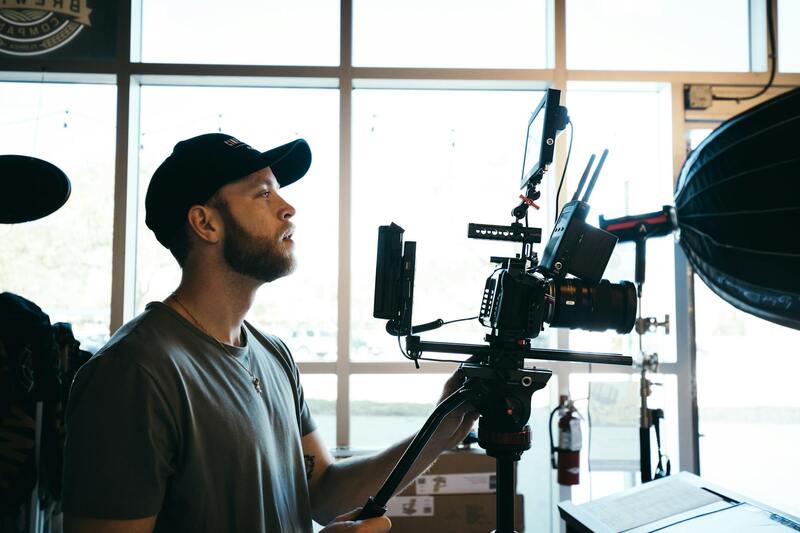
Implementing drone photography in Miami's real estate market requires adherence to established guidelines that ensure responsible and professional use of UAV technology. This involves understanding and following local policies related to airspace restrictions, privacy considerations, and operational standards. Expertise in these areas not only safeguards the integrity of the marketing process but also enhances the perceived professionalism of the listing.
Before deploying drone equipment, it is crucial for operators to secure proper authorization from relevant authorities, such as the Federal Aviation Administration (FAA) and local governing bodies. This process typically includes registering the drone, obtaining necessary permits, and ensuring pilots are certified through standard training programs focused on safe drone operation and compliance with legal frameworks.
In addition to official permits, real estate professionals should establish comprehensive operational protocols that include pre-flight site assessments, securing the area from pedestrians and other obstructions, and maintaining a flight log for accountability. These steps help mitigate risks and provide a clear record of compliance—an important aspect for maintaining credibility within the industry.
Best practices also encompass maintaining transparency with clients regarding the use of drone imagery, especially around sensitive areas or private properties. Clear communication about safety measures and adherence to privacy standards builds trust and underscores the employer’s commitment to ethical business conduct. Furthermore, employing high-quality drone equipment and utilizing skilled operators ensures that imagery meets professional standards and accurately portrays the property’s full potential.
With technology rapidly advancing, staying informed about new regulations, technological enhancements, and industry standards is essential. Regular training sessions, participation in professional drone pilot networks, and consultation with legal experts can help real estate agents and photographers maintain a compliant operation, ultimately safeguarding the investment and reputation of all parties involved.
Role of Drone Photos in Competitive Market Environments
In the highly dynamic and competitive landscape of Miami real estate, drone photography serves as a strategic differentiator that can significantly influence property valuation and market positioning. With the ability to capture expansive aerial views and highlight unique property features, high-quality drone images elevate listings beyond traditional photography, attracting a larger pool of potential buyers and investors.
When properties are presented with professional drone imagery, they stand out in online listings and marketing materials. This increased visibility often correlates with higher engagement rates and faster sales cycles. Properties showcased with compelling aerial visuals tend to generate more inquiries and open house visits, which can translate into premium offers and shorter time on the market.
Moreover, drone images evidence the property's surrounding environment — including neighborhood amenities, proximity to beaches, parks, or commercial centers — which are critical factors influencing buyer decisions and ultimately, the transaction price. Showcasing these features effectively can justify higher price points and enhance a property's perceived value.
Real estate professionals aiming for a competitive advantage should leverage drone imagery as part of a comprehensive marketing strategy. By doing so, they can create a compelling visual narrative that emphasizes a property's unique qualities, maximizes online engagement, and fosters quicker, more profitable sales.
- Expanded visual storytelling to highlight property features and location benefits
- Enhanced online listing appeal for increased visibility
- Greater engagement from prospective buyers and investors
- Potential for higher sale prices owing to superior presentation
Investing in drone photography aligns with the evolving expectations of today's digital-savvy real estate market, where quality imagery can significantly influence the perception of a property's value and availability.
Impact of Drone Imagery on Real Estate Market Value
Drone photography has revolutionized how properties are presented in the Miami real estate market, significantly influencing perceived market value. The inclusion of high-quality aerial images offers prospective buyers a comprehensive view of a property’s scope, layout, and surrounding environment, which can directly elevate its market positioning. Properties showcased with professional drone shots often command higher prices due to their enhanced visual appeal and the ability to demonstrate key selling points such as expansive land, proximity to desirable amenities, and impressive architectural features from unique vantage points.
Investors and homeowners recognize that compelling aerial imagery aids in creating a strong first impression, vital in the competitive Miami market. Elevated visual presentation not only attracts more potential buyers but also establishes a perception of higher quality and exclusivity. In many instances, properties with cinematic drone footage or panoramic shots are perceived as more valuable, which can lead to an increase in listing price negotiations and final transaction prices.
Further, comprehensive aerial visuals can help highlight features that traditional photography might miss—such as landscape design, outdoor living spaces, or neighborhood integration—factors that substantially influence buyer perceptions of value. By capturing the unique attributes of a property and its surroundings, drone imagery facilitates a more impactful marketing strategy that aligns with buyer expectations and enhances overall property valuation.
Benefits of Drone Photography for Real Estate Listings
- Improves online listing attractiveness, leading to increased inquiries and viewings
- Provides a broader context of the property's surroundings, emphasizing location advantages
- Allows showcasing of property scale and exterior features from multiple angles
- Creates a professional and modern image that appeals to tech-savvy buyers
- Enables virtual tours and remote viewing experiences, expanding reach beyond local buyers
Correlation Between Drone Quality and Property Prices
The quality of drone imagery directly impacts how a property’s value is perceived. Higher-resolution images with professional stabilization and precise framing tend to produce more engaging visuals, which are more effective in capturing buyer attention and driving online engagement. In Miami’s diverse market, properties equipped with superior drone visuals often experience quicker sales at higher prices, reflecting the added perceived value derived from refined presentation tools.

Cost-Benefit Analysis of Using Drone Photography
While integrating drone photography involves initial investment in equipment or professional services, the potential returns justify the expenditure. Enhanced imagery can lead to increased listing prices, reduced time on market, and higher closing prices, especially in premium markets like Miami. Real estate professionals should consider the profitability of drone marketing as part of their holistic listing strategy, recognizing that compelling visuals significantly influence buyer interest and offer competitiveness.
Regulations and Best Practices for Drone Use in Miami Real Estate
Adherence to official guidelines ensures efficient and responsible drone operations. It is essential to understand Miami's specific requirements, including obtaining necessary permits, respecting privacy laws, and operating within designated airspace. Employing certified drone pilots with technical expertise ensures high-quality imagery and compliance with local standards. These best practices foster trust and professionalism, ultimately adding value to the property presentation.
Role of Drone Photos in Competitive Market Environments
In Miami’s vibrant real estate scene, drone photography serves as a crucial differentiator. Listings with aerial visuals stand out in crowded online platforms, attracting more serious buyers and investors. Strategic use of drone images highlighting key property features, neighborhood advantages, and unique selling points enhances marketability. Properly executed drone visuals can position a property as a premium offering, enabling it to command higher prices and achieve faster turnover rates in highly competitive areas.
Case Studies and Examples of Drone Impact on Property Prices
Case evaluations across Miami demonstrate that properties featuring professional drone imagery consistently garner higher offers and experience shorter sales periods. For instance, luxury estates captured with dynamic aerial shots often see a price premium equivalent to 5-10% compared to similar listings without aerial visuals. These outcomes affirm the tangible influence that high-quality drone imagery exerts on market prices, especially when used as part of a comprehensive marketing approach aligned with buyer preferences.