Overview of Aerial Real Estate Photography
Aerial real estate photography has revolutionized the way properties are marketed, providing a captivating perspective that ground-level images cannot achieve. By utilizing advanced drone technology, professional images and videos are captured from heights that highlight the full extent of a property’s landscape, surrounding amenities, and architectural details. This approach allows real estate professionals to showcase properties in a manner that is both visually compelling and highly informative for potential buyers.
This specialized form of photography involves the use of unmanned aerial vehicles (UAVs), commonly known as drones, equipped with high-definition cameras capable of capturing sharp, vibrant images and smooth video footage. These tools enable a comprehensive visual representation of properties, differentiating listings in a competitive Miami real estate market. Moreover, aerial footage can beautifully depict large estates, waterfront properties, or properties in scenic neighborhoods, helping buyers gain a better understanding of the property’s scale and environment.
The execution of aerial real estate photography requires a combination of advanced technology, professional expertise, and precise planning. Experienced operators use stabilization hardware to ensure smooth footage, even in challenging weather conditions. The images and videos produced can be integrated into digital marketing campaigns, virtual tours, or listing presentations, making them an essential component in a comprehensive property marketing strategy.
Ultimately, aerial real estate photography serves as a powerful tool to attract serious buyers, providing a unique vantage point that enhances the visual storytelling of a property. Trusted providers in Miami leverage cutting-edge drone technology and creative techniques to deliver high-quality content that elevates property listings, helping clients achieve faster sales at optimal prices.
Types of Aerial Photography Used in Real Estate
In the realm of aerial real estate photography, various techniques are employed to showcase properties in the most compelling manner. The primary methods include standalone drone photography, panoramic shots, 3D mapping, and cinematic video production. Each type serves a distinct purpose and caters to specific marketing needs, ensuring a comprehensive visual presentation that appeals to potential buyers.
Standalone drone photography involves capturing high-resolution images from multiple angles, emphasizing the property's exterior, landscaping, and surrounding environment. These images are often integrated into listing galleries to create a striking first impression. Panoramic shots extend this concept by providing a wide-angle view, allowing viewers to grasp the property's placement within its neighborhood or scenic surroundings.
3D mapping and aerial scans are increasingly popular for offering virtual walkthroughs of larger properties or developments. These methods create detailed topographical models that enhance online listings with immersive views. Additionally, cinematic drone videos combine sweeping aerial footage with smooth transitions, effectively narrating the property's story and highlighting its unique features in motion. This dynamic approach engages potential buyers more deeply, fostering an emotional connection and increasing the likelihood of inquiries.
Choosing the appropriate aerial photography style depends on the property’s size, location, and target market. A large estate benefits from comprehensive video tours and panoramic images, while a compact urban property might prioritize crisp exterior shots to capture its essence quickly. Professionals skilled in aerial photography understand these nuances, employing tailored techniques to maximize visual appeal and convey the property's full potential.
Legal Regulations and Permits in Miami
When engaging in aerial real estate photography within Miami, adherence to established operational standards is essential. The city enforces specific requirements to ensure safe and responsible drone use, including the acquisition of necessary permissions for flight operations. These regulations are designed to safeguard the privacy of residents and maintain airspace safety, dictating parameters such as flight altitude, designated no-fly zones, and time restrictions. Certified operators must comply with Miami-Dade County's guidelines, including deadlines for permit applications and operational protocols.
Precisely navigating these regulatory frameworks requires detailed planning and adherence to official procedures. Licensed drone pilots and production companies possess the expertise to manage these processes efficiently, ensuring seamless integration of aerial services into property marketing strategies without disruptions or legal complications. It is crucial for clients to select providers well-versed in local regulations to guarantee all necessary permits are obtained prior to shooting.
Professional aerial photography services always prioritize compliance, leveraging their knowledge to operate safely and ethically within Miami’s airspace. By doing so, they ensure the integrity of the project while delivering high-quality visuals that enhance the property's appeal.
Overview of Aerial Real Estate Photography
Aerial real estate photography involves capturing images and videos of properties from elevated perspectives, primarily using unmanned aerial vehicles, commonly known as drones. This innovative approach provides a comprehensive view of a property and its surroundings, offering potential buyers and investors a more immersive understanding of the assets on offer. High-resolution imagery captured from the air can highlight the property's exterior features, landscaping, nearby amenities, and neighborhood context, thereby enhancing marketing efforts. Additionally, aerial photography can effectively showcase large estates, commercial developments, and land parcels that traditional ground shots may inadequately represent. The quality of visuals obtained through professional aerial photography elevates property listings, making them stand out in competitive markets. Advanced drone technology allows for a variety of creative shots, including dynamic flyovers, orbit shots, and detailed close-ups, ensuring a diverse portfolio of images to attract interest.
Benefits for Real Estate Marketing in Miami
In the vibrant Miami real estate market, visually compelling marketing materials are essential for attracting discerning buyers and investors. Aerial real estate photography services offer multiple advantages, including:
- Enhanced Visual Appeal: Striking aerial imagery captures the uniqueness and grandeur of high-end properties, drawing immediate attention from prospective clients.
- Comprehensive Property Representation: Many properties, particularly expansive estate land, benefit from aerial shots that showcase the full scope of the property and its contextual environment.
- Competitive Edge: Properties listed with professional aerial visuals tend to generate more views online and result in quicker sales, as they stand out amongst other listings.
- Versatile Marketing Content: The combination of photos, videos, and 360-degree panoramas creates engaging content for websites, social media, virtual tours, and print advertisements.
- Strategic Presentation: Aerial views can illustrate proximity to beaches, parks, transport hubs, and other amenities that boost the property's attractiveness.
Miami’s diverse architecture, coastal landscapes, and vibrant neighborhoods make aerial imagery especially impactful. Sellers and agents leveraging these services can better communicate a property's value proposition while highlighting unique selling points that traditional ground photography might overlook. Furthermore, the dynamic perspective provided by drones allows potential buyers to visualize the property within its larger geographic context, facilitating informed decision-making and increasing engagement.
Understanding the Range of Aerial Photography Techniques in Real Estate
In the realm of aerial real estate photography, selecting the appropriate technique is fundamental to capturing images that maximize property appeal and showcase unique features effectively. Different methods serve distinct purposes, from broad landscape shots to detailed close-ups, each contributing to a comprehensive visual story of the property.
One prevalent approach involves high-altitude drone flights that provide expansive views of large properties, estates, and their surrounding environments. These images are especially effective for demonstrating the property's scale, layout, and its relationship to nearby amenities or natural features. Such aerial imagery helps potential buyers envisage living within the space, appreciating both the grandeur and context of the property.
For showcasing specific exterior details, lower altitude shots taken from drones deliver crisp, close-up perspectives of architectural features, landscaping, pools, and outdoor amenities. These perspectives enrich listings by highlighting craftsmanship, outdoor living spaces, and unique property elements that may not be easily captured from ground level.
Panoramic photography, often achieved through specialized camera mounts on drones or traditional panoramic equipment, creates wide-angle views that encompass the full vista around a property. Such images are particularly valuable for properties with scenic surroundings or significant outdoor spaces, enhancing the visual appeal and storytelling capacity of listings.
Video captures complement still imagery by offering dynamic, moving perspectives of the property, including walkthroughs or flyover sequences. These are highly engaging in virtual tours and social media content, providing potential buyers with a more immersive experience. The combination of images and videos enables a well-rounded presentation of the property, its environment, and the lifestyle it offers.

Implementing Strategic Aerial Photography for Maximum Impact
The key to effective aerial real estate photography lies in aligning the technique with the property’s unique features and marketing goals. A professional service assesses the landscape, architectural style, and desired visual message to determine optimal flight altitudes, angles, and camera settings. Shooting during optimal lighting conditions—such as early morning or late afternoon—ensures images are vibrant and shadow-free.
Moreover, pre-planning flight paths and shot sequences ensures comprehensive coverage, capturing all critical aspects of the property while maintaining safety and compliance with local regulations. Post-processing enhances aerial images through color correction, sharpening, and stitching methods, delivering polished visuals that stand out in listings.
By leveraging the right combination of methods and meticulous planning, real estate professionals can produce compelling visual narratives that attract attention, foster engagement, and drive inquiries. The visual storytelling provided by expertly executed aerial imagery will continue to be a pivotal element in competitive property marketing strategies, especially in vibrant markets like Miami where scenery and architecture are integral to property appeal.
Technical Aspects and Equipment Used
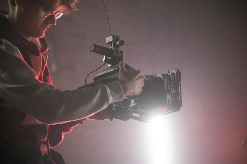
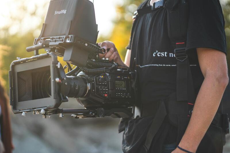
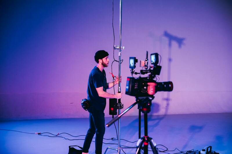
Delivering high-quality aerial real estate imagery necessitates the use of advanced equipment designed to capture detailed and vibrant visuals from various altitudes and angles. Professional aerial photography services employ specialized drones equipped with high-resolution cameras capable of capturing crisp images even in challenging lighting conditions. These drones often feature stabilized gimbal systems, which ensure camera steadiness during flight, minimizing motion blur and producing smooth footage.
Camera specifications play a critical role in the quality of aerial images. Industry-standard cameras used in aerial real estate photography typically include full-frame sensors that deliver exceptional detail and color accuracy. Additionally, a range of lens options—wide-angle lenses for expansive property views and telephoto lenses for capturing intricate architectural details—are utilized to tailor imagery to specific marketing needs.
Advanced drones also incorporate technologies such as GPS-guided flight paths and obstacle avoidance systems, which facilitate safe and precise maneuvering around complex property terrains. These features allow for repeatable flight paths, essential for creating consistent image sequences for video tours or listing galleries.

For data management, professional providers leverage sophisticated editing software to enhance raw images—adjusting contrast, color balance, and sharpness—to produce captivating visuals that highlight a property's finest features. Some services also integrate aerial videography, employing high-definition cameras capable of capturing dynamic footage that adds a cinematic element to real estate marketing.
Legal Regulations and Permits in Miami
When engaging in aerial real estate photography within Miami, understanding and complying with the local aviation regulations is essential to ensure smooth operations. The city of Miami, along with federal agencies, oversees the use of drones for commercial purposes, including real estate marketing. Specific permits and adherence to operational guidelines help maintain safety standards and respect for private property rights.
Operators are required to register their drones with the appropriate authorities, which typically include the Federal Aviation Administration (FAA) and local municipal entities. Registration involves providing details about the drone, the operator, and the purpose of the flights, ensuring accountability and traceability.
Operational restrictions may include maintaining visual line-of-sight during flights, operating only during daylight hours, and avoiding congested areas or restricted airspace such as near airports and sensitive locations. Miami's urban environment, with its numerous high-rise buildings and dense neighborhoods, necessitates thorough planning and consideration of these stipulations to prevent incidents and legal complications.

While many professional aerial photography providers are well-versed in local regulations, clients should verify that their chosen service operates with the proper permits and follows all required procedures. This not only helps in avoiding potential interference with other airspace users but also guarantees that the imagery captured is legally obtained and can be confidently used across various marketing platforms.
In addition to regulatory compliance, insurance coverage is an integral aspect of professional aerial photography services. Insurance policies protecting against accidental damage, loss, or injury during drone operation are common among reputable providers. This further fosters trust and demonstrates a commitment to safety and professionalism, ultimately supporting the effective marketing of Miami properties.
Choosing the Right Aerial Photography Service in Miami
When selecting an aerial real estate photography provider in Miami, it is essential to evaluate their experience, equipment, and adherence to best practices. A reputable service will employ certified drone pilots who are adept at capturing high-quality imagery while respecting Miami’s complex airspace regulations. The provider should demonstrate proficiency in maneuvering drones in dense urban environments, including high-rise districts and busy neighborhoods, where obstacles such as buildings and power lines are prevalent.
Assessing a company's portfolio is a critical step. A professional service will showcase a diverse range of real estate projects, illustrating their capability to produce sharp, well-composed shots that highlight a property's best features from multiple angles. Additionally, they should utilize advanced stabilization technology and high-resolution cameras to ensure clarity and detail in every shot.
Customer reviews and testimonials can shed light on the reliability, punctuality, and overall satisfaction associated with a particular provider. Good communication is also vital—your chosen service should clearly outline the process, including flight planning, safety considerations, and timelines, ensuring smooth coordination from start to finish.
Beyond technical expertise, the provider should offer comprehensive support, including advice on optimal shoot times to maximize natural lighting, and tailored packages that suit the specific needs of your property. Ensuring seamless integration of aerial imagery into your existing marketing campaigns further amplifies its effectiveness and reach.
Ensuring Quality and Safety in Aerial Real Estate Photography
When selecting an aerial real estate photography service in Miami, it is essential to prioritize providers who implement rigorous safety protocols and adhere to best practices for drone operations. A reputable company invests in ongoing training for its pilots and technicians, ensuring they are well-versed in the latest operational procedures and safety standards. Proper maintenance of equipment, including regular calibration and updates to drone firmware, also plays a crucial role in delivering consistently high-quality imagery.
High-resolution imaging equipment, capable of capturing sharp, detailed visuals even in challenging lighting conditions, is standard among leading providers. These images not only enhance property appeal but also provide potential buyers with a clear, accurate representation of the property, which is vital in competitive markets like Miami. The integration of advanced stabilization tools minimizes motion blur and ensures smooth footage, a critical factor when showcasing expansive properties or intricate architectural details.
Customizing Aerial Photography Packages
Many providers offer customizable packages tailored to meet specific real estate marketing objectives. These packages can include a variety of services such as 4K video footage, panoramic shots, twilight photography, and even 3D virtual tours. Engaging a provider that offers comprehensive solutions ensures that all visual content aligns with your marketing strategy, maximizing the property's visual impact.
Post-Production and Editing Excellence
High-quality aerial imagery is only as effective as its post-production process. Top-tier services utilize professional editing tools to enhance colors, correct distortions, and ensure consistency across all visuals. Subtle enhancements can significantly improve the visual appeal without misrepresenting the property's actual appearance. Detailed aerial images, combined with compelling narratives, can markedly increase engagement and generate more interest from prospective buyers.
Coordination and Timing for Optimal Results
Effective aerial real estate photography in Miami requires meticulous planning concerning flight schedules and environmental conditions. Optimal shoots are usually scheduled during times of natural lighting, such as early morning or late afternoon, when the lighting accentuates architectural features and landscape aesthetics. Clear communication between you and the service provider helps coordinate these details, ensuring the results meet expectations and fit within your broader marketing timeline.
Ensuring Seamless Integration into Marketing Campaigns
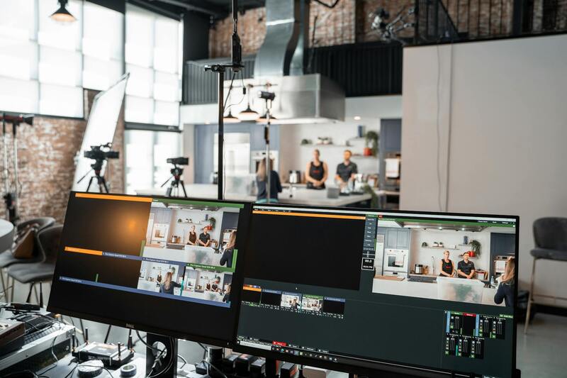
Once captured, aerial imagery should seamlessly integrate into your marketing materials to create a cohesive presentation. Whether used across websites, virtual tours, brochures, or social media platforms, high-quality images enhance the visual narrative of the property. Professional services often provide support in formatting and optimizing visuals for various channels, ensuring maximum engagement and outreach.